
Permian Period. Texas, about 280 million years ago. In a small ox-bow lake, Orthacanthus, a large shark, lurks in shallow water to attack Eryops, a tetrapod related to frogs and salamanders. The enigmatic lepospondyls consist of the terrestrial microsaur Pantylus crawling on a log and the boomerang-skulled Diplocaulus swimming below. The aquatic anthracosaur Cricotus, a large, crocodile-like predator on the right, is related to the more terrestrial Diadectes seen in the far left background.
Painting by Robert J. Barker, 1996. © American Museum of Natural History.
KILLER IN OUR MIDST
By Dan Dorritie
PREFACE
"The climate is like a wild beast, and we're poking it with sticks."
-- Wally Broecker
Deep beneath the surface of the sea, buried in the oxygen-depleted muds that have accumulated over the ages on the underwater margins of the continents, lies a vast store of natural gas that probably well exceeds, in its carbon equivalence, the entire supply of all other oil, gas, and coal on the planet. Most of this immense store of natural gas, largely comprised of methane, lies trapped in icy cages called hydrates. Below these hydrates is a huge quantity of methane as free gas bubbles, blocked from release by the hydrate, and temperature and pressure conditions above. Still more methane, as hydrate, is found in the permanently frozen (permafrost) regions that surround the poles.
Methane is a much more powerful greenhouse gas than carbon dioxide, the gas which is currently warming our globe, even though methane remains in the atmosphere for a much shorter time. If released abruptly, seafloor methane has the potential to deliver a stunning jolt of heat to the planet's already increasing temperatures. Even if released more gradually, seafloor methane will inevitably compound the problem of global warming. But abruptly or gradually, as we warm the planet by our dumping of carbon dioixde into the atmosphere, the seafloor will also warm, and its methane will inevitably be released.
This book is about the release of that methane, and, in particular, about the possibility of methane catastrophe. Methane catastrophes have occurred several times in Earth's history, and when they have occurred, they have sometimes caused abrupt changes in the history of life, and at least one significant extinction. That extinction, at the end of the Permian Period 250 million years ago, is the greatest in the history of life. More than 90% of the then-existing species perished, and the course of life on Earth was altered forever.
If a methane catastrophe were to happen in the near future, it is likely that not only would a considerable percentage of existing plants and animals be killed off, but a large percentage of the human population as well, as a result of the climate change and significantly more hostile environmental conditions. Yet we may well be heading toward such a catastrophe, produced by our warming of the planet.
Just how rapidly seafloor methane will be released depends on numerous factors that are quite difficult to assess. It is possible that seafloor methane will be released so slowly that it will only have a relatively minor warming effect on Earth's climate. On the other hand, because the coming methane release will be the result of our warming of the planet via the burning of fossil and other acrbon fuels, it could happen much more quickly. Indeed, it seems that we are currently pumping the greenhouse gas carbon dioxide into the atmosphere at a much faster -- perhaps tens to hundreds of times faster -- rate than has ever before naturally occurred in the last half billion years or so of the Earth's history. The catastrophic warming we are causing is -- to the best of our knowledge -- unprecedented since the early days of our planet, billions of years ago. Such warming could well lead to methane catastrophe.
The onset of a methane catastrophe would be abrupt because it could be initiated by a major submarine landslide, which can happen in a matter of days or even hours, or by the venting of vast quantities of seafloor methane over a period of decades. These events can take place in what is essentially a geological eyeblink. Additional slumping and/or venting can continue for centuries to millennia.
The amount of methane that can be released is indeed massive. Estimates of the amount of seafloor methane generally range from about 5000 billion metric tons to around 20,000 billion metric tons (a metric ton is equal to 1.1 imperial tons, the standard ton used in the United States), though they usually range around 10,000 billion metric tons. This amount of methane contains about 7500 billion metric tons of carbon, vastly more than all the estimated carbon in all fossil fuels: petroleum, coal, and natural gas. There is a simple way to put 10,000 billion metric tons of methane into perspective: it contains about ten times the amount of carbon (largely in the form of carbon dioxide) as does the entire atmosphere. Moreover, though methane entering the atmosphere is quickly oxidized, it is oxidized to carbon dioxide, so the problem of its warming ability will remain with us for thousands of years into the future.
A methane catastrophe, therefore, is an abrupt surge of greenhouse gas that could rival or exceed the carbon dioxide warming of the planet. It could potentially overwhelm the natural heat regulatory system of the Earth, which operates in a much more gradual way, and on a much more protracted time scale. The quantity of methane that could be released is so massive there would be no remedial action that people would be able to take to mitigate it except in the most superficial way. Once a methane catastrophe were to begin, there would be major consequences for the planet and its inhabitants, human and other, and we would be able to do little except wait it out. Methane, in a very real sense, is the joker in the deck of global warming.
As with the current increase in atmospheric carbon dioxide, a large methane release will undoubtedly contribute to an increase in acid rain, and, through its impact on global warming, a further rise of sea level, increased desertification, increased heavy precipitation, and extreme weather events. The slowing of ocean circulation or its actual stagnation because of greater planetary warmth are also possibilities. Such a slowing would paradoxically produce a decreased transport of warm water to the coasts of northeastern North America and northernmost Europe, making for much colder winters. In addition, the destabilization of methane within seafloor sediments can send 20 meter (60 foot) high tsunamis crashing into nearby coastlines.
A methane catastrophe can have other major consequences in addition to sudden global warming. It can accelerate the slow but deadly acidification of the surface ocean (down to about 100 meters, or about 300 feet), which is now occurring as a result of the increase of carbon dioxide in the atmosphere and ocean. The methane can combine with dissolved oceanic oxygen, depleting the deeper part of the ocean (that is, the ocean below about 100 meters) of oxygen, and killing off the oxygen-using (aerobic) organisms at those depths. As acidification penetrates the deep ocean, even organisms that do not use oxygen (anaerobes) will be affected.
Then there are the worst case scenarios. With the warming of the world ocean, its chemical balance and biological composition will change. The ocean will become stratified, with mixing between its surface and the deep ocean becoming increasingly restricted. If the deep ocean becomes fully anoxic (devoid of oxygen), it will also become toxic, as the remaining anaerobic organisms pump out the deadly gas hydrogen sulfide. In sufficient quantities, that gas could escape oceanic confinement to poison the atmosphere and, combining with the iron in the blood's hemoglobin, kill terrestrial organisms, including us.
But the composition of the atmosphere could also change in a second way, because the amount of free oxygen depends on two things: the actual production of oxygen (by the ocean's photosynthetic plankton and terrestrial green plants) and the delivery of large amounts of carbon (as part of a "rain" of organic debris from organisms closer to the surface) to the ocean's bottom. This carbon, if not removed from the global carbon cycle by sinking and eventual burial in the ocean floor, will combine with oxygen and lower its concentration in the atmosphere.
Once oceanic anoxia kills off aerobic marine organisms (those which require oxygen to live), the natural regulatory system for carbon will be sent into a tailspin. The amount of organic debris produced in surface waters will likely be reduced, the amount that rapidly descends to the ocean floor will be reduced, and the proportion that gets decomposed on the way to the bottom will be significantly reduced. Exactly how this will play out is unclear, because certain of these changes will operate to slow the removal of carbon from the global carbon cycle (which will act to decrease the amount of oxygen in the atmosphere), while others will enhance it (increasing atmospheric oxygen). When a similar disruption of the marine ecosystem occurred at the end of the Permian, a quarter of a billion years ago, atmospheric oxygen dropped to a fraction (about 2/5ths) of its previous level. But increased oxygen could be just as bad: oxygen ions (sometimes referred to as free radicals) can inflict genetic damage to DNA, causing mutations and cancer.
We are certainly on the verge of releasing a huge amount of permafrost and seafloor methane within a very short time; we may also be on the brink of methane catastrophe. By our own actions -- by our continuing and increasing use of carbon fuels -- we are slowly but inexorably creating the conditions during which a such a methane release, catastrophic or more gradual, could occur. We probably have time to prevent a catastrophe, but there is a certain non-negligible possibility that we have already crossed -- or will shortly cross -- an invisible threshold that will render a methane catastrophe inevitable and unstoppable.
Major anthropogenic global warming by carbon dioxide and possible methane catastrophe will be events more cataclysmic than any that can befall Earth, except for an impact with a giant asteroid or comet, or a stellar explosion in our neighborhood of the Milky Way. These other events, however, are quite rare and unlikely in our immediate future.
Major anthropogenic global warming by carbon dioxide and possible methane catastrophe, by contrast, are highly likely and much more immediate. More importantly, unlike those other possible cataclysms, both are preventable -- probably -- if we take them seriously, begin to understand them, and -- most difficult of all -- begin to take steps to avert them.
It has become fashionable to dismiss predictions of catastrophe, partly because they have become so common. Many of us have become jaded, what with one such prediction after another. We used to hear a good deal about nuclear holocaust, or nuclear winter, but as those threats seem to have faded in the public consciousness, there are others which have replaced it. We now hear of doomsday asteroids, the ozone hole, SARS (severe acute respiratory syndrome), bird flu, global warming, and the obliteration of species. The number of threats seems to be increasing.
And, actually, that number is increasing.
Prior to this epoch in human history, people simply did not have the ability to impact our planet in potentially catastrophic ways. Unfortunately, we now do have that ability. The ozone hole is a simple example. Never before was humanity on the verge of destroying this gaseous umbrella which protects us (and all other organisms that live at or near the surface of the Earth) from deadly ultraviolet light. Humanity simply didn't have that kind of power. But the advent of chloro-flouro-carbon (CFC) refrigerants gave us that ability, and the ozone layer sustained significant damage before the problem began to be addressed. Luckily, this is a problem for which there is a ready solution, and by banning the production of these ozone-harming chemicals, we have begun to bring the problem under control.
The problem of carbon dioxide emissions, consequent global warming, and the prospect of a major seafloor methane release, however, will not be addressed so easily. We currently have no technology to trap and hold large quantities of carbon dioxide, and we are not likely to have such a technology for many decades in the future -- if indeed we ever will. Some of the excess carbon dioxide we produce is in fact currently slipping beyond our potential grasp, entering the oceans at the astounding rate of about a million metric tons (a metric ton = 1.1 standard ton) per hour, and increasing the acidity of seawater.
There is, in addition, great resistance in a world economy driven and dominated by fossil fuels to shifting the energy base of that economy. Enormous corporate profits and personal fortunes, and the success of political efforts on their behalf, are also at stake. Slowing the stampede to catastrophically higher global temperatures and ocean destruction will require substantial international effort. Even so, should we today stop spewing carbon dioxide into the atmosphere, global temperatures will continue to increase for some time into the future.
Despite our aversion to warnings of imminent catastrophe, our problem may be that we are not alarmed enough. Because of the delayed consequences of our dumping carbon dioxide into the atmosphere, the major effects of global warming will only be starting just as the world supply of oil is well on its way to depletion (about 2050). But already startling environmental changes -- the early, "minor" effects of global warming -- are occurring on Earth:
·With the exception of 1996, the years from 1995 to 2004 constitute 9 of the 10 warmest years since systematic record keeping began in 1861.
·The year 2005 was the warmest year since records have been kept. The next warmest years, in order, are, 1998, 2002, 2003, and 2004.
·Globally, glaciers have retreated, on average, almost some 15% since 1850. Glacial retreat has been recorded in Tibet, Alaska, Peru, the Alps, Kenya, Antarctica.
·Alaskan temperatures have risen about 2.8°C (5°F) in the past few decades.
·In the past several decades, about 40% of Arctic Ocean sea ice has disappeared. (Some researchers now believe, however, that at least part of this sea ice loss may be due to changing wind patterns over the North Pole, but these wind changes, themselves, may be due to a warming climate.)
·Between 1965 and 1995, the amount of melt water from the Arctic region going into the North Atlantic was about 20,000 cubic kilometers (about 4800 cubic miles), the equivalent of the fresh water in all of the Great Lakes combined (Superior, Huron, Erie, and Ontario) with the exception of Lake Michigan. Preliminary calculations indicate that an additional 18,000 cubic kilometers (4300 cubic miles) or so could shut down ocean circulation in the North Atlantic. That shutdown could occur in two decades or less, though most scientists believe it will take much longer. The Intergovernmental Panel on Climate Change, comprised of thousands of climate scientists worldwide, puts the likely slowing at about 25% by 2100.
·Trade winds across the equatorial Pacific have slowed because of higher humidity, and are projected to do so even more as time passes. The increase in humidity is the result of increased evaporation, traceable to global warming. This slowing of Pacific winds will also slow the ocean surface currents that the winds push along. Some scientists fear that at some point "the switch will be tripped" and nutrient-rich bottom water will no longer rise to the surface in the eastern Pacific (a "permanent El Niño" situation which did exist about three million years ago). These waters feed the plankton which feed the anchovies in one of the world's greatest fisheries. Much of the anchovy harvest is dried, ground up, and added to chicken feed, of which it is a major protein constituent. If the switch does trip, good-bye to inexpensive chicken.
·Upper ocean temperatures have risen between 0.5 and 1.0°C (0.9 to 1.8°F) since 1960. Deeper water has also warmed, but not by as much. The total amount of energy that has gone into the oceans as a consequence of global warming, however, is staggering: enough to run the state of California for 200,000 years.
·In addition to significant retreats of the glaciers on Greenland's margins, as of 2005 Greenland's massive ice sheet is melting at more than twice the rate it was in the previous three years. Glaciologists report that portions of the sheet which were solid ice just a few years ago are now riddled with meltwater caverns.
·The deep waters of the Southern Ocean (that which encircles Antarctica) have become significantly colder and less salty than they were just ten years ago. This is presumably due to the melting of Southern Ocean sea ice and parts of the Antarctic ice cap. Deep ocean waters have been previously presumed to be fairly isolated from climate warming but the data obtained from depths of four to five kilometers (more than two to three miles) now suggests otherwise. Such changes could significantly impact global ocean circulation.
·The Southern Ocean, which may absorb more carbon dioxide than any other region of the global ocean, as of more than twenty-five years ago ceased to absorb additional carbon dioxide. In fact, its ability to absorb carbon dioxide seems to be declining -- even as atmospheric levels of that gas are reaching ever higher levels -- most likely due to increased wind speed over that part of the global ocean. The higher wind speed in turn has been attributed to both global warming and the destruction of the Antarctic ozone layer. Because oceans eventually absorb most of the carbon dioxide that goes into the atmosphere, the declining ability of the Southern Ocean to absorb carbon dioxide is a particularly ominous development.
·Huge expanses of floating ice around Antarctica have collapsed into fragments in just weeks, after existing for tens of thousands of years. In addition, the ice that currently covers West Antarctica, known as the West Antarctic Ice Sheet (WAIS), which was quite recently (as of 2001) judged by the UN's Intergovernmental Panel on Climate Change (IPCC) as unlikely to collapse before the end of this century, or even for the next millennium, may now be starting to disintegrate, according to the head of the British Antarctic Survey. If this ice sheet does collapse, global sea level will rise by about 5 meters (16 feet).
·While global daytime temperatures, on average, increased only about 0.33°C (0.6°F) between 1979 and 2003, nighttime temperatures have risen more than 1°C (1.8°F).
These environmental changes have had significant biological effects:
·In the eastern North Atlantic, warm-water phytoplankton (marine organisms that photosynthesize, produce oxygen, and constitute the bottom of the food chain) has moved north 1000 km (600 miles) over the past 40 years.
·In 2004, almost a quarter of a million breeding pairs of seabirds in islands north of Scotland failed to produce more than a few dozen offspring. Their reproductive failure is most likely due to the North Atlantic phytoplankton changes, and the consequent breakdown of the marine food chain. Many of the affected birds migrate back and forth between the Scottish islands and areas around the Southern Ocean (off Antarctica) over the course of the year. Starved in the north, they will never make it back to the south. Similar changes have been observed off the West Coast of the United States in 2005.
·Krill, small (about 5 cm/2 inches in length), shrimp like creatures which are a main food source for seals, whales, and penguins in the Southern Ocean, have declined in places to just 20% of their previous number in just 30 years.
·Grass now survives the winter in places on the Antarctic Peninsula, the warmest part of that frigid continent. When grass last was able to survive Antarctic winters is unknown.
·In the 17 year period from 1987 to 2003, the number and size of major wildfires in the western U. S. has increased dramatically. Compared to the 17 year period stretching from 1970 to 1986, the number of major wildfires has increased fourfold, and the area burned by major fires has increased sixfold. All of the presumed causes for this increase -- the earlier melting of snow, increased summer temperatures, an extended fire season, and an increase in the area of high-altitude forests which is vulnerable to such fires -- can be traced to global warming.
·The small increase in global nighttime temperatures indicated above (1°C/1.8°F), is sufficient to have reduced the biomass (the total mass of roots, stems, leaves, and grain) of rice, humankind's most important crop, by 10%. Rice is the primary foodstuff for more than half of the population of the world.
With the warming, the release of methane has begun to follow:
·The Western Siberian Peat Bog, comprising an area of a million square kilometers (about 385,000 square miles, roughly the combined size of France and Germany), has begun to melt. This area is underlain by permafrost (permanently frozen ground that has existed since the Ice Age) perhaps a kilometer (about 3000 feet) deep. The permafrost contains an enormous amount of methane hydrate, possibly as much as a quarter of the total inventory of continental methane. As this permafrost warms and melts -- an irreversible process -- methane is released. This melting may add a quantity of methane to the atmosphere roughly equivalent to that released by all other natural and agricultural sources, increasing global warming by 10 to 25%.
·Already, methane emissions from certain areas of Siberian permafrost is proceeding much more rapidly than previously estimated. These extensive areas, characterized by Ice Age deposits of wind-blown dust (called loess) with high carbon and very high ice (50 to 90%) contents, are bubbling out methane at a rate five times higher than earlier presumed. Overall, these "yedoma" regions are contributing an additional 10 to 63% the total rate of methane release from the wetlands of the north.
These are only the early effects, ripples from the storm which is to come. Remedial action is still possible, but the likelihood of catastrophe becomes more certain with each passing year.
I discovered the possibility of methane catastrophe as a student of paleontology. Paleontologists study fossils in order to reconstruct the history of life on Earth. Inevitably, many students of paleontology are interested in those episodes of biological cataclysm and change known as mass extinctions. Our interest has certainly been stimulated, in part, by the determination in 1980 of the cause of the extinction of the dinosaurs some 65 million years ago. (There is still some dispute about that cause, but most scientists accept that it was an extraterrestrial impact.)
My particular interest was in finding the cause of the end-Permian extinction, the greatest extinction event of them all. (The event that killed off the dinosaurs was only the second greatest.) As I worked on that problem, however, I quickly realized that what I presumed to be the cause of that extinction was still around in today's world, and, with global warming, will become a significant threat.
This book is the result of that recognition. I have here traced the history of our understanding of mass extinction, our discovery of the vast quantities of methane that lie just off the shores of our continents, the various theories of the Permian extinction, the evidence for methane catastrophe at that time, the reasons why we must be concerned about the possibility of methane catastrophe today. I have attempted to write so that the general, educated reader can understand, and I have tried to do so without compromising the science. I hope to leave the reader with a sense of what we are doing to our environment, and the appalling consequences that can ensue if we fail to act to mitigate our activities. Such an understanding is essential if we as citizens are to be able to control our destinies.
This is a tale filled with superlatives. The reader will encounter the greatest extinction event of all time, the longest ice age, the greatest oceanic current, the longest period of stability in the Earth's magnetic field, the greatest volcanic eruptions, the largest exchangeable carbon reservoir, the largest continent (a "mega continent"), the biggest ocean, the largest known bacterium (Thiomargarita namibiensis), the longest mountain range in the world, and, of course, methane catastrophe. The tale is full of superlatives because there is no other way to tell it.

Geologic Time Scale showing the time divisions of the Phanerozoic. The Phanerozoic is divided into three Eras, and the Eras into Periods.

Geologic Time Scale showing the divisions of the Cenozoic. The Cenozoic is divided into two Periods, and they are divided into Epochs. Years before present are approximate in all of these time charts.

Barringer Crater, also called Meteor Crater, Arizona


Mariner Photos of Mars.
PART I: THEN
THE ABYSS OF TIME
"What seest thou else in the dark
backward and abyss of time?"
Prospero to Miranda, in Shakespeare's The Tempest
Time of Mountains
So long ago my father led me to
The dark impounded orders of this canyon,
I have confused these rocks and waters with
My life, but not unclearly, for I know
What will be here when I am here no more.
I've moved in the terrible cries of the prisoned water,
And prodigious stillness where the water folds
Its terrible muscles over and under each other.
When you've walked a long time on the floor of a river,
And up the steps and into the different rooms,
You know where the hills are going, you can feel them,
The far blue hills dissolving in the luminous water,
The solvent mountains going home to the oceans.
Even when the river is low and clear,
And the waters are going to sleep in the upper swales,
You can feel the particles of the shining mountains
Moping against your ankles toward the sea.
Forever the mountains are coming down and I stalk
Against them, cutting the channel with my shins,
With the lurch of the stiff spray cracking over my thighs;
I feel the bones of my back bracing my body,
And I push uphill behind the vertebrate fish
That lie uphill with their bony brains uphill
Meeting and splitting the mountains coming down.
I push uphill behind the vertebrate fish
That scurry uphill, ages ahead of me.
I stop to rest but the order still keeps moving:
I mark how long it takes an aspen leaf
To float in sight, pass me, and go downstream;
I watch a willow dipping and springing back
Like something that must be a water-clock,
Measuring mine against the time of mountains.
But if I go before these mountains go,
I'm unbewildered by the time of mountains,
I, who have followed life up from the sea
Into a black incision in this planet,
Can bring an end to stone infinitives.
I have held rivers to my eyes like lenses
And rearranged the mountains at my pleasure,
As one might change the apples in a bowl,
And I have walked a dim unearthly prairie
From which these peaks have not yet blown away.
(Ferril, 1934)
Some cultures, like the Hindu and Mayan and other native cultures of the Americas, have believed that time is cyclical, with human lives and events repeated in an endless sequence. A few Greek philosophers thought that time was infinite, and many cultures have believed that time is in fact circular (Gorst, 2001). In Jewish and Islamic culture, and during the Christian era of the West, however, most people believed that time had a specific origin and direction, as in the religious tradition that the world began -- was "created" -- about six thousand years ago. Many of those who do not accept the severely limited time allotted by Scriptural analysts -- like the six thousand years meticulously calculated by the Protestant Bishop Ussher (1581-1656) -- nonetheless think that the Earth came into existence quite recently.
For numerous centuries, the Bible was the "one book" with which all other information in the world had to be reconciled. But in the later years of the eighteenth century, gentlemen scientists of Western Europe, themselves good Christians who believed in the literal truth of the Bible and who often attempted to demonstrate its truth through their study of the natural world, began to realize that strictly enumerated Biblical time was insufficient to explain the evidence they saw in the rocks around them. These gentlemen scientists and students of nature, able to engage in scientific studies because of their wealthy leisure, gradually discovered that Biblical accounts of the nature of the world and its history either had to be in error or were simply metaphorical.
Most notable among them was the Scottish naturalist James Hutton (1726-97), who, in his 1788 book, Theory of the Earth, stated that his geological investigations revealed that there had been a "succession of worlds" comprising the history of the Earth. Hutton knew that certain of the rocks in his general neighborhood were sedimentary in origin, that is, they had been formed by the slow accumulation of sediments washed from the land into ocean basins. Over enormous lengths of geologic time, these sediments had hardened into solid rock, and by a then unknown process had come to be the subsoil foundation -- the bedrock -- of parts of the Edinburgh area of Scotland.
These sedimentary rocks were flat-lying, just as when they were formed on the ocean floor. It may seem common-sensical to us today, but the recognition that sedimentary rocks formed from the accumulation of mud's and sands on the bottom of the sea, and thus must have originally been horizontal, is one of the many facts of our world that only became obvious when someone had specifically pointed it out. In this case the someone was a gifted Danish naturalist, Nicolaus Steno (1638-86), whose discovery is called the principle of original horizontality.
But Hutton, an astute observer, noted an additional, remarkable fact about the rocks of the Edinburgh area. In some places the sedimentary rocks overlay other sedimentary rocks, which rose at sharp angles to the rocks above them. [See below, The unconformity at Jedburgh ] Clearly these rocks could not have been produced during the same sedimentary episodes as those above them: they often were turned upright, broken, warped and misshapen. To Hutton these upturned rocks provided confirmation that long episodes of sedimentation had preceded the one which had produced the flat-lying rocks (Montgomery, 2003); they were, in fact, relics of previous "worlds." Indeed, when Hutton evaluated all his evidence, he saw a succession of "worlds" which stretched as far back in time as could be observed. He therefore famously declared that the geological record displayed "no vestige of a beginning, no prospect of an end."
Hutton's was a stunning conclusion, unacceptable to many. Where Ussher had found a very compressed history of Heaven and Earth recorded in the Bible, Hutton, reading in the Book of Nature, found that geologic time was effectively infinite. But Hutton's evidence was compelling, and those who followed him in examining rocks and living things, confirmed that he was correct. Hutton was the first to understand the testimony of the earth itself regarding its own age, and to peer into the abyss of deep time.
We now know that geologic time does have a beginning, in a Universe which also has a beginning, about 13.7 billion years ago. Nonetheless, geologic time is enormous, and its vastness is so far outside of our own ordinary experience of the world that it may ultimately be beyond our imagining or comprehending.
To Hutton and those who shortly followed him, however, the vastness of geologic time was only beginning to be glimpsed. Hutton recognized that the sedimentary rocks he examined were the products of long natural processes. Sediments were eroded from mountains and soils, and carried to the sea by rivers. Except in flood stage, relatively little sediment was transported by the rivers, so the deposition of sediment in the deep ocean was slow and protracted. The smaller the particle of sediment, the more likely it was to complete the journey, so mud and sand made it to the ocean floor much more often than rocks and boulders.
Once at the bottom of the ocean, the layers of mud or sand built up slowly over the centuries. The farther from the land, the source of the sediment, the longer the process took. As the layers built up, however, they gradually squeezed out the water within them. Eventually, with sufficient time and sediment accumulation, they began to harden into rock. Then, somehow -- perhaps through the agency of heat and volcanism -- they could become part of the land.
Early on in the scientific investigation of the Earth -- before Hutton, in fact -- it was recognized that the lowest sedimentary layers -- "strata" -- should be the oldest, because they were the first to be deposited. The determination that the deepest strata were the oldest and the shallowest (topmost) were the youngest (other things being equal) is known to geologists as the principle of superposition (also discovered by Nicolaus Steno).
 |
The unconformity at Jedburgh. An unconformity is a discontinuity in the rocks.
Note how the lower sedimentary strata (from the Silurian Period, between about 438 and 408 million years ago), which were deposited on the seafloor and were therefore originally horizontal, are now vertical and twisted. Once they had been turned vertically (or perhaps during that process), these older strata were highly eroded. The overlying, younger strata (called the Old Red Sandstone, from the Devonian Period, about 408 to 367 million years ago) retain the horizontality of their original deposition. (Drawing by John Clerk, Lord Eldin. Hutton, 1795.)
|
But the fact of superposition merely provided a guide to the relative age of sediments in particular rocks. Rates of sedimentation were carefully studied, along with rates of erosion of the sediment source material, but estimates of absolute geologic age were at best only educated guesses. The difficulties involved in obtaining good estimates of geologic time were to plague Darwin, for whom extended periods were necessary to accomplish evolution by natural selection.
Nonetheless, Darwin and others were able to make guesses about the rate of geological processes and the temporal extent of some geological episodes of geologic time that were not unreasonable. One estimate by Darwin (for the "denudation of the Weald," that is, the erosion of an area [the Weald] of Sussex, England, southeast of London) is now recognized to be many times longer than accurate, but the estimate was still within an order of magnitude (a factor of ten) of the correct one: not bad for someone who entirely lacked modern radiometric dating tools. Moreover, such estimates of tens and hundreds of millions of years to accomplish particular geological processes were far closer to the truth than the Biblical accounting of Archbishop Ussher. It was only with the discovery of radioactivity in the late nineteenth century, and the development of radiometric dating techniques in the twentieth that the true extent of geologic time became known.
Radioactivity was discovered by Henri Becquerel (1852-1908) and Marie (1867-1935) and Pierre (1859-1906) Curie in the final years of the nineteenth century. In 1904, Ernest Rutherford (1871-1937) suggested that radioactive decay might be used to determine the age of rocks. As quickly as 1905, the first crude estimates of the absolute ages of the planet's rocks using radioactive minerals had been made, independently, by John Strutt (later, Lord Rayleigh; 1842-1919) and Bertram Boltwood (1870-1927), and some of the rocks dated clocked in at the astonishing age of two billion years (Albritton, 1986).
The technique of employing radioactive decay to determine the age of rocks (and other materials) is called radiometric dating. It rapidly became an extremely important tool for geologists, who needed to find the absolute ages for the events they saw recorded in the rock and fossil records. Arthur Holmes (1890-1965) and others explored and improved the radiometric dating technique in the early-to mid-twentieth century; still others employ it widely today, both in geology and archaeology.
Contemporary researchers are engaged in their own attempts to plumb the immensity of geologic time. To do so, they use radioactive elements, which decay at steady rates. Over great lengths of time, uranium turns to lead. Over time, certain forms (isotopes is the proper term) of the gas argon change to other isotopes of argon, and to potassium. Other radioactive elements also change, each at its own rate. Most elements (and the isotopes of elements) are not radioactive, but those that are provide scientists with a means for exploring geologic time.
The principles behind radiometric dating are easy to understand. Consider this analogy: in my refrigerator stands a container of orange juice. Each day with breakfast I have an eight ounce glass of OJ. You come by, notice that the juice container, once full, is now partially empty. You wonder how long it has been since I started drinking the juice from the container.
The calculation is an easy one. You simply check the label to find out how much was originally there, and then measure how much is gone. Because you know the rate at which I have been drinking the OJ, you can determine how many days have passed since the container was full. Measuring the amount of time which has passed by using radioactive decay is a very similar process. The principle is just the same: one determines how much was there originally, learns the rate of decay (like the rate of consumption of the OJ) and figures out how much is gone. From that, it's simple math to calculate how much time has passed.
But while the principle is easy, its application for the determination of the passage of geologic time is quite difficult. First of all, radioactive decay does not occur in precisely the same way as the consumption of orange juice. In the orange juice analogy, I consumed a specific amount of juice each day. Radioactive decay works in a different way: in a specific period of time, called the half-life, half of the original radioactive material decays into another isotope. In an equal amount of time, half of the remaining radioactive material decays. In yet another equal amount of time, still another half of the remaining radioactive material decays. And so on.
Obviously, though one can keep dividing the remaining material in half, and half, and yet again in half, one can never get to the end of the process until the last radioactive atom decays. (This protracted decay is one of the reasons radioactive materials can be so dangerous: the radioactivity can last a long time.) But one can get to the point where there is so little of the original radioactive material remaining that it becomes impossible to accurately measure it. At this point, one can no longer use that particular radioactive material to measure the amount of time which has elapsed since the decay process began. This is why those scientists who measure geologic time generally employ radioactive materials which decay over very long periods of time (that is, those which have long half-lives) for their calculations.
 |
| Radioactive Decay. The "half-life" of a given radioactive substance is the amount of time it takes for half of the atoms of that substance to be transformed into another substance. A substance's half-life may be a tiny fraction of a second up to billions of years, but all radioactive substances decay in the same way. If a substance has a half-life of 10 minutes (or days, or years, or billions of years), for example, after 10 minutes (or days, or years, or billions of years), half will have decayed into something else. After another 10 minutes (or days, or years, or billions of years), another half will be gone. This graph shows how much of the original substance is gone after each unit of half-life, whatever that unit (minutes, days, or years, or billions of years) may be for the particular radioactive substance. (Abbott, 1996, p. 5) |
In determining geologic ages, the exact rate of decay of the radioactive material used must be figured. Rocks containing the necessary radioactive materials must be located and processed. Tiny amounts of radioactive materials must be extracted from these rocks, and those amounts measured with enormous precision. Contamination from other possible sources must be excluded. Extremely sophisticated instruments and highly trained and experienced personnel need to be employed in such endeavors. Even so, determinations of exactly when particular geologic events took place often can only be established within about 1% accuracy, though precision has increased greatly within the past decade.
A dating accuracy to within about a percent, however, has given us extraordinary insight into the history of our planet and the history of its life. Earth's existence goes back some 4.6 billion -- that is, 4,600,000,000 -- years, back to the formation of the solar system. For the first 800 million years of its existence, Earth was periodically subjected to severe bombardment by rocky, gaseous and dusty objects of all sizes. Some were simply the debris left over from the formation of the solar system, others more consolidated meteors or comets or asteroids, and at least one other, a protoplanet about half the size of Earth itself, which early in our history (probably within 50 million years of the formation of the Earth) smashed our planet with such force that a huge mass of molten material spurted out and solidified into our Moon. About 3.8 billion years ago, the first rudimentary living things came into existence
Attempting to conceive of these stretches of time is a daunting, possibly ultimately impossible task. Geologic time is simply immense. Think, for example, of the founding of our nation, back in 1776. Back then, people used horses for transportation, used muskets for firearms, lit their homes with candles and oil lamps, cooked their food and heated their homes with wood or sometimes peat in their fireplaces. There weren't telephones, cars, computers, planes, the assembly line, atomic bombs, television, skyscrapers, indoor plumbing, or electricity brought through wires to power lamps, stoves, heaters and air conditioning.
Yet if we use an average American lifespan of about 75 years as a rough yardstick, the beginning of our independent existence as a nation in 1776 took place only three lifespans ago, laid end-to-end. The Civil War was less than two lifespans ago, laid end-to-end. Women won the right to vote barely more than one human lifespan ago (1920). Indeed, there are many women alive today who were born before American women had the right to vote in national elections.
Ten lifespans (750 years) ago, Europeans had not yet discovered the New World, and Europe itself was pretty much a backwater, despite having mounted several largely unsuccessful religious Crusades against Muslims in the Holy Land. Mongols were threatening Europe's eastern frontiers, and the bubonic plague lay more than a hundred years in the future.
The Abbasid Caliphate, which represented one of the high points of Islamic civilization, had reached its zenith of cultural and scientific achievement, and was in its last days. The destruction by the Mongols of the caliphate capital, Baghdad, home to perhaps a million people, lay just ahead.
The Ch'in empire of northern China had recently been conquered by the Mongols; the conquest of the southern Chinese Sung empire by Kublai Khan also lay only a few years in the future.
One hundred lifespans (7500) ago, most people lived in small agricultural villages. Animals were only beginning to be domesticated. Writing had not yet been invented, nor metal technology. What some geologists believe was the great flood that inspired the Biblical tale of the deluge of Noah was just inundating the ancient agricultural communities along the Black Sea coast.
Thought of in this way, human history, despite its own enormity -- with all the names and dates of presidents, wars, exploration, migration and settlement, the birth and death of empires -- seems very short. Now compare geologic time. The Earth was formed more than 60 million lifespans ago. The first living things appeared about 50 million lifespans ago. The first animals with skeletons, more than 7 million of our yardsticks ago. The extinction of the dinosaurs, almost a million. There is nothing in our experience or imagination -- despite our mere "three score years and ten" [plus five] years being packed with events: early childhood, elementary, junior high, high school and college, the family life we are born into and the family life we may create for ourselves, the various jobs and places we may live or visit -- which prepares us to deal with such enormities of time.
The 18th century naturalist Georges-Louis Buffon (1707-88), contemplating the enormous lengths of geologic time that he and his contemporaries were beginning to discover, wrote, "Why does the human mind seem to lose itself in the length of time...? Is it not that being accustomed to our short existence we consider one hundred years a long time, and have difficulties forming an idea of one thousand, cannot imagine ten thousand years, or even conceive of one hundred thousand years?" The mental difficulty people faced in comprehending vast lengths of time affected Buffon's own calculations. He found that it was "necessary to shorten it as much as possible to conform to the limits of human intelligence" (Roger, 1997, p. 412).
But even Darwin emphasized that "it is highly important for us to gain some notion, however imperfect, of the lapse of years" to understand Earth and life itself. To illustrate the vastness of geologic time, he provided the following exercise:
"Few of us, however, know what a million really means: Mr. Croll gives the following illustration: take a narrow strip of paper, 83 feet 4 inches in length, and stretch it along the wall of a large hall; then mark off at one end a tenth of an inch. This tenth of an inch will represent one hundred years, and the entire strip a million years. But let it be borne in mind, in relation to the subject of this work, what a hundred years implies, represented as it is by a measure utterly insignificant in a hall of the above dimensions" (Origin of Species, 1859, Chapter X).
In order to comprehend the history of our planet, and the history of life, however, we need ways to measure geologic time, and to place milestones along this temporal route. Walter Alvarez, a geologist at the University of California at Berkeley, has suggested one approach. He proposes thinking of geologic time in million year intervals, as indicated:
Millions of years ago (Ma) Event(s)
4590 Formation of the Earth
about 4580 Collision of large protoplanet with Earth; formation of the Moon
about 4400 Early continents
about 3800 First evidence of living things
about 2500 Great increase of oxygen in the atmosphere; evolution of the first cells with enclosed nuclei (eukaryotic cells)
about 560 Soft-bodied, multi-cellular organisms appear
543 Animals with hard parts appear in fossil record; almost all major groups of animals appear within next 10 million years. This marks the beginning of the Paleozoic, the age of "old life," commonly called the "Age of Trilobites."
250 Paleozoic ends with mass extinction; the Mesozoic, the age of "middle life," commonly called the "Age of Dinosaurs," begins.
65 Mesozoic ends with mass extinction; the Cenozoic, the age of "recent life," commonly called the "Age of Mammals," begins.
1/4 Homo sapiens appears
Clearly, however, reaching back through enormous quantities of time to attempt to elucidate exactly what happened millions of years ago, and why particular events happened, are formidable tasks.
Geologic Time and
the History of Life
Though our own species has only been around for about a quarter of a million years, the solar system condensed out of gas and dust about 4.6 billion years ago. For about the first 800 million years of its existence, Earth was bombarded with comets, meteors, and similar cosmic debris. Consequently, though life may have evolved earlier, the first real evidence of life didn't appear until about 3.8 billion years ago. Single-celled organisms were the only living things on Earth for billions of years. The first multi cellular organisms, which probably evolved between 1.5 and 1 billion years ago, were quite small and lacked hard parts, and like the earlier single-celled organisms, left few traces. Larger soft-bodied life forms evolved about 560 million years ago, but the first organisms with skeletons -- thus able to leave behind solid fossils of themselves -- only evolved just prior to some 543 million years ago.
The sudden appearance in the fossil record of creatures with hard parts, at 543 million years ago, marks a biological change so significant that geologists and paleontologists have marked that point on geological time as perhaps the most important in the history of the planet. The first geological time period containing those hard-part fossils is called the Cambrian, and the entire span of geologic time which preceded it as Precambrian (sometimes written as Pre-Cambrian). The 543 million years from the beginning of the Cambrian to the present is called the Phanerozoic Eon, the eon of "visible life."
The Cambrian Period represents the start of the Paleozoic Era (543 to 250 million years ago; millions of years ago is indicated by geologists as Ma), the era of "ancient life," frequently referred to colloquially as the "Age of Trilobites." The Paleozoic was characterized by the evolution of many kinds of marine invertebrates, the first fish, the emergence of advanced life forms from the sea onto the land, the first forests, and the rise of early mammals and dinosaur ancestors. The Paleozoic Era came to a close with the end of the Permian Period, about 250 million years ago, in the greatest mass extinction of the Phanerozoic.
The Paleozoic was followed by the Mesozoic Era (250 to 65 Ma), the era of "middle life," known colloquially as the "Age of Dinosaurs." This period was characterized by the emergence of the dinosaurs, large fish-like marine reptiles, flying reptiles (pterosaurs), social insects such as bees and ants, and the first birds and flowering plants. (It turns out the earliest (most ancient) flowering plant, Archaefructus sinensis, and the earliest placental mammal, Eomaia, both come from the same Mesozoic 125-million-year-old Yixian Formation in Liaoning, China: Sun, 2002; Ji, 2002). The Mesozoic Era also ended with a great mass extinction, about 65 million years ago, which killed off all dinosaurs, large marine reptiles, flying reptiles, and lots of other organisms.
Last of these eras is the Cenozoic Era (65 Ma to the Present), the era of "recent life," which followed the Mesozoic. It is colloquially referred to as the "Age of Mammals," and includes all time from the end of the Mesozoic to the present. Though their ancestors existed from before the end of the Paleozoic Era, mammals were not the dominant animal life form on the land, having been out-competed by the dinosaurs. With the demise of the dinosaurs, however, mammals became dominant on the land, while some (bats) shared the skies with birds and others (whales, dolphins, seals and other marine mammals) shared the oceans with bony fish and sharks.
A Geologic Time Chart
Geologic time is divided into eons, which in turn are divided into eras, eras into periods, periods into stages. (This is similar to our dividing years into days, days into hours, hours into minutes, minutes into seconds.)
In addition, geologic periods are often divided into "early," referring to the older portion of the period, and "late," referring to the younger, or more recent part of the period. Sometimes a "middle" interval is also employed.
Because real geologists deal with real rocks, they also use another terminology that reflects the placement of rocks as they are normally found in rock formations. As the "early" rocks from a given period have been buried longer, they are found lower in their formations, while rocks from "late" in the period are found above, in the upper parts of formations. Thus "lower" = "early," and "upper" = "late." Wherever possible, I have employed the terms early and late.
Geologic Time Scale. This scale indicates the major divisions of geologic time from the formation of the Earth, 4600 million years ago (that is, 4.6 billion years ago) to the present. The major divisions are referred to as Eons. Although life began sometime in the Archean (perhaps around 3500 million years ago), it remained as single cells for perhaps 2000 million years. Only in the Mesoproterozoic did multi-cellular forms evolve, but even they remained microscopic, and without hard-part fossils, until just before the Phanerozoic. The Phanerozoic is the Eon of "visible life," during which life has left sufficient fossils that scientists may trace its development.
Mass Extinctions
When the miners and naturalists of western Europe began to carefully examine rocks and fossils over two centuries ago, they noted some important geologic characteristics. Certain rock types -- those called igneous and metamorphic -- did not seem to contain fossils. Because these rocks frequently contained crystals (as well as mineral ores), they were referred to as crystalline rocks. The crystalline rocks yielded no clues to their ages (though they seemed to have been around for a long time), because they had not come into existence by processes like sedimentation, where older sediments were covered by more recent ones. Moreover, containing no fossils, they revealed no secrets about the history of life. These rocks, often found in mountainous areas, were designated by the term "Primary."
The more lithified (hardened) sedimentary rocks, seemingly later in origin, were assigned to a "Secondary" period. These rocks, often found in the hillier regions, frequently contained fossils. Although 200 years ago it was not yet clear that these fossils formed an evolutionary progression, it was nonetheless becoming obvious that certain fossil organisms were often found in related sedimentary rocks but were absent on others, where an entirely different fauna could be found.
Less lithified but nonetheless fossiliferous sedimentary deposits often including mud's and gravels, were found in flat, low-lying areas. These were referred to as "Tertiary" deposits. (These terms seem to have first been used by Giovanni Arduino in 1760: Cutler, 2003, p. 196.) But even these relatively young deposits were cut by still more recent river valleys, which earned the designation "Quaternary." Thus, early on in the more systematic examination of its geology, Earth's history was divided into four different ages. Later, some sedimentary rocks were recognized to be of Primary age, and a long "Transition" period was introduced between the Primary and Secondary ages (Phillips, 1840).
Today we do not today employ this same terminology, though the terms Tertiary and Quaternary -- for the third and fourth ages -- live on. What is noteworthy, however, is that some of the basic divisions and successions of geologic time that we recognize today were also noted even during the first pioneering attempts to understand earth history, more than a century and a half ago. The divisions noted early on remain the fundamental divisions of geologic time, largely on the basis of the absence or presence of particular fossilized organisms.
The rocks that once were assigned to the Primary age are now largely considered to be of Precambrian origin (before 543 million years ago), while those of the Transition period are largely assigned to the Paleozoic Era. Two of the main divisions recognized by early nineteenth century geologists, between the Transition period and the Secondary, and between the Secondary and the Tertiary, are roughly reflected in our own divisions of the Phanerozoic between Paleozoic and Mesozoic, and Mesozoic and Cenozoic. As the paleontologists of the nineteenth century discovered and classified the unfamiliar fossils of the creatures of the Phanerozoic, the differences in characteristics between Transition, Secondary, and Tertiary (roughly, the Paleozoic, Mesozoic, and Cenozoic) faunas stood out ever more clearly.
There was a certain amount of continuity between the biotas of different time periods, to be sure, but there were also striking differences. Dinosaurs, for example, first identified in the 1840's, were found in Secondary (Mesozoic) strata, but were absent from later rocks. Mammals, on the other hand, were present in the Tertiary, but were generally absent during the Secondary, and neither mammals nor dinosaurs were present in the Transition. Hence, as the modern terminology -- Paleozoic, Mesozoic, Cenozoic -- came to be adopted, it reflected the growing understanding that significant biotic changes characterized the history of life, and that there were major, perhaps catastrophic, biological divisions between one geologic interval and the next. The French paleontologist Georges Cuvier (1769-1832), in fact, described these enormous biotic changes as "revolutions."
Charles Darwin (1809-82) and others, however, were troubled by these abrupt biotic changes. Instead of accepting the apparent abruptness of these significant biological changes which "catastrophists" like Cuvier simply recognized as part of the fossil record, Darwin and other important figures of nineteenth century geology like Charles Lyell (1797-1875) were "uniformitarians," who believed in the gradual transformation of both rock and organisms. The big biological shifts needed explanation, and Darwin (Origin of Species, 1859, Chapter X) and others suggested they were due to the fact that the fossil record was incomplete.
The incompleteness of the fossil record is an enduring problem with which paleontologists have had to wrestle. One of its causes, when it is considered carefully, is obvious: the soft parts of dead organisms decay rapidly, and usually only the hard parts -- shells, bones, teeth, plant cellulose -- remain. But even these hard parts disappear: they are gnawed upon by rodents or larger bone-crushing animals like hyenas; they dry and bleach and fall to dust under the sun; they get slowly dissolved by even slightly acidic rain. Small creatures may be consumed whole; organisms with small populations leave few bones at all.
Much has been made. of course, of the incompleteness of the geologic and fossil records by those opposed to Darwin's theory of evolution. They point to the lack of "missing links" between older and more recent organisms, for example, and especially to the small number of fossils that link man with other great apes.
But their objections are not based on common sense. Think of your own ancestors. You had two parents, and four grandparents. Each generation back, the number doubles (barring intermarriage and incest): eight great grandparents, sixteen great great grandparents, and so on. Were you to try to go back and find the remains of ancestors further and further removed in time, how successful do you think you would be, even with the best genealogical tools? Some of your ancestors died in battles and their corpses were consumed by scavengers. Some drowned in rivers, lakes or the ocean: where are their remains now? Some died in deserts and their bones were gnawed on by rats and mice for the calcium they contained. Some died in fires so hot their bones were turned to ash, just as if they were cremated. Some were buried peacefully in quiet churchyards, only to have floods bury the graveyards themselves. A few may have become part of someone else's stew.
The further back in time one would go, looking for the remains of one's ancestors, the less likely it is that one would find their undisturbed graves; and the more likely it is that they would have disappeared without a trace. Most of us would be fortunate to find any remains older than a few centuries, much less from thousands of years ago. Going back tens of thousands, or hundreds of thousands, of years, to when there were far fewer people on the planet, and they were far more dispersed, there must be far fewer remains, and our recovery of them far more likely to be a matter of luck. The lack of success in finding ever more remote ancestors, however, does not mean that they did not exist. Our being here confirms that they were indeed present.
That, simply put, is why paleontologists find so few fossils of our ancient ancestors, or any of the so-called "missing links." Those we do find, of course, are highly prized. And over time paleontologists do find more and more bits of fossil evidence which provide clues as to our evolutionary heritage.
But while some gaps in the fossil record have gotten filled, and the lineages of particular creatures have become ever more clear, significant gaps still remain. Moreover, some of these gaps involve not just a few organisms, but extremely large numbers. In addition, at the time of these particular gaps, many organisms seem to have left no descendants whatsoever, and their lineages have become extinct, as if a kind of biological holocaust had taken place.
Gaps in the fossil record -- a few major ones and a myriad minor ones -- turn out to be normal and expected in the history of any given species. So too, the coming into existence of new species, and the extinction of old ones, just like the regular appearance of birth and death notices for individual human beings found in the daily newspapers, represent the normal unfolding of the history of life. The regular demise of species is so familiar to paleontologists that the process has even been given a name: background extinction. Similarly, though without a specific name, is the equivalent background origination of species.
Species generally don't last very long, at least by geological standards: the average terrestrial species is believed to last for about a million years; marine organisms, presumably because of their more stable environments, may last an average of ten million years. Species, therefore, are constantly winking into and winking out of existence, like the flashes of fireflies over cornfields in the warm Midwestern summer dusk.
Periodically, however, there are extraordinary episodes of species mortality. They involve the demise of huge numbers of types of organisms, possibly millions at one time (the number of species on the planet has been estimated to be between a million and ten million; these episodes commonly claim more than 50%). As a consequence of this colossal mortality, they create unprecedented opportunities for surviving organisms, as decimated as the survivors themselves well may be. But despite the fact that these episodes serve as major transitions in the history of life, opening the world for a whole different suite of organisms, it is the massiveness of the biological destruction which initially captured scientific imaginations. Consequently, paleontologists refer to these biological holocausts as mass extinctions.
As the knowledge of the history of life increased during the nineteenth and twentieth centuries, the major divisions that had been noted early on, between the biotas (living things, taken as a group) of the Paleozoic Era and the Mesozoic, and between the Mesozoic Era and the Cenozoic, became ever more clear. More and more fossils of known organisms were found, as well as the fossils of an increasing number of unknown organisms. Together with greater precision in identifying the various geologic formations of which the organisms were part, and more precise dating of those formations, the patterns of the history of life emerged very distinctly.
The recently deceased John Sepkoski (1948-99) of the University of Chicago developed statistical methods to evaluate the accumulating data from the fossil record. His analysis confirmed that mass extinctions had occurred both at the end of the Paleozoic and the end of the Mesozoic. These mass extinctions are generally referred to by the names of the geologic time periods which end those eras: the end-Permian (the Permian being the last geologic period of the Paleozoic Era) and the end-Cretaceous (the Cretaceous being the last geologic period of the Mesozoic). The geologic demarcation ("boundary") between the Mesozoic and the Cenozoic (the first period of which is the Tertiary) is referred to as the K-T boundary, for the Cretaceous (indicated by the geologic symbol "K") and the Tertiary ("T").
In addition, Sepkoski confirmed mass extinction events at the end of the Ordovician Period (about 443 million years ago; geologists use the abbreviation "Ma" for "millions of years ago"), in the Late Devonian Period (about 354 Ma), both in the Paleozoic Era, and at the end of the Triassic Period (about 206 Ma), during the Mesozoic. All told, some five major mass extinctions punctuate the history of life. (The middle Cambrian, end-Botoman extinction, discovered by Phil Signor in the early 1990's, also ranks as a major mass extinction, but it has not yet been incorporated by most paleontologists into their ordinary thinking about mass extinctions. This may be because the extinction came so early in the Phanerozoic, at a time when there were no fully terrestrial organisms, and few creatures that resembled modern forms.) There are several smaller but yet still massive extinctions identified in the fossil record, perhaps the most important of which is that marking the end of the Paleocene Stage (about 55 Ma).
The Greatest Mass Extinctions and Selected Lesser Extinction Events
520 Ma | middle Cambrian (end Botoman) |
443 Ma | end Ordovician |
354 Ma | late Devonian |
250 Ma | end Permian |
206 Ma | end Triassic |
183 Ma | early Jurassic (early Toarcian) |
65 Ma | end Cretaceous |
4.8 Ma | end Paleocene |
33.7 Ma | end Eocene |
(Ma = millions of years ago)
The five major mass extinctions are indicated in bold.
Mass extinctions are a prominent though rare feature of the history of life. Though we don't know about specific extinction events before the eon of visible life (the Phanerozoic), that is, prior to 543 Ma, we can assume that even then living things faced repeated crises during which large numbers of organisms perished. During the eon of visible life, however, the large numbers of fossils, and the relative completeness of the fossil record allows us to identify numerous massive die-offs in which a large percentage of species disappeared from the planet. Each of the five major mass extinctions killed off from about 60% to 90% of the then existing species, and the several lesser but still dramatic extinctions took smaller tolls.
 |
| Extinctions during the Phanerozoic, the last 543 million years of geologic time. The letters at the bottom of the chart refer to geologic periods: C = Cambrian, O = Ordovician, S = Silurian, D = Devonian, C = Carboniferous, P = Permian, T = Triassic, J = Jurassic, K = Cretaceous, T = Tertiary. Disregard the black dots. The five greatest extinctions are those at the end of the Ordovician, in the Late Devonian, at the end of the Permian (P-T), the end of the Triassic, and the end of the Cretaceous (K-T; this is the extinction which killed off the dinosaurs). (Kerr, 1995, from Sepkoski) |
The notion of a mass extinction deserves some elaboration and contemplation. There are millions of species on our planet: people and domestic cats and tigers and lions and hippos and Canada geese and sugar maples and honeysuckle and string beans and roses and violets and blue whales and rainbow trout. There are lots of species of oaks and pines and mushrooms and bacteria and grasses. There are lots and lots of different species of bees, butterflies, beetles, and ants, as well as lots and lots of what are known as "true" bugs. This list, clearly, is quite inadequate to mention all but a few of the almost innumerable species -- perhaps currently about ten million in all (though fewer in the past) -- which inhabit our extremely biologically diverse globe.
During the great mass extinctions, 60 to 90% of biological species became extinct. That doesn't mean that every single individual in a species was killed off in an instant (though they could be), but it does mean that enough individuals were killed that the species population fell below the limit which the species needed to reproduce itself. Within a short time, perhaps a few generations, the species was gone. What extinction means is that every single individual which belonged to that extinct species is gone. Every one is dead.
On the other hand, those species which survived a mass extinction may not have fared much better. After all, even one pregnant female, or a single clutch of eggs, or one tiny acorn or mustard seed could live and resuscitate a decimated population. Among those single-celled organisms which reproduce asexually, a single survivor among uncountable numbers of dead could prevent extinction. In a mass extinction, the only difference between a species which survives and one which does not may be that in the surviving group there was 99.99% mortality, and in the extinct group mortality was 100%. In any case, since a species may contain anywhere from about 100,000 individuals (common for many mammals) to hundreds of millions or billions or so (as for mosquitoes or ants), a mass extinction that killed off 90% of species means that probably well over 99% of all individual organisms on the planet were destroyed. The carnage caused by mass extinctions is colossal, almost unimaginable.
Enigmas of the Mass Extinctions
As the reality of mass extinctions became evident, the question inevitably arose: what could possibly have caused such enormous carnage? It wasn't as if there were a lot of corpses lying around, as in a colossal crime scene. Besides, fossils themselves, while not exactly corpses, are the dead remains of once living things. So a mass extinction doesn't mean that there are lots of corpses, but -- counter intuitively -- that there are none. The normal evidence of death, which for paleontologists is the evidence of having lived, suddenly ceases, and no further remains of the affected organisms are found.
In the rocks, mass extinctions reveal themselves merely as major biological transitions: in the older (generally deeper) strata are assemblages of particular organisms, but in younger (generally shallower) strata many of these organisms are gone, replaced by a different set of creatures. There are few clues as to the cause of the destruction. Even the amount of time a mass extinction event took -- years or millions of years -- is obscure. Possibly the cause of each mass extinction is different. The paucity of clues is compounded by the extreme age of these mass extinction events: paleontologists must solve mysteries woven into the gossamer fabric of deep time.
One of the mass extinction events is almost mythic: that of the extinction of the dinosaurs at the end of the Cretaceous, some 65 million years ago. This mass extinction not only swept an enormously successful and highly charismatic group of animals -- the dinosaurs -- to their deaths in what was perhaps a geological eye-blink, but it also killed off numerous other creatures which had been around for many tens of millions of years: marine reptiles, flying reptiles, many birds, plants and marine organisms.
The cause of this extinction has attracted the interest and conjectures of numerous paleontologists and interested amateurs. Among the many suggestions they have put forward are that the demise of the dinosaurs was due to the rise of mammals who stole and ate dinosaur eggs, or out competed dinosaurs in other ways, or to disease, or to a cooling climate, or to the purported "facts" that dinosaurs were sluggish or stupid. Such suggestions run up against other (real!) facts: that the early ancestors of dinosaurs, around 250 million years ago, had out competed early mammals for domination of the land, that some dinosaurs could move quite rapidly (a lot faster than a human being can run), that they were quite as smart as they needed to be to survive and evolve for more than 180 million years, hundreds of times longer than our own species, Homo sapiens, has been around. But most perplexing is the fact that when the dinosaurs went, lots of other, unrelated creatures went with them.
A major breakthrough came in late 1970's, when Luis and Walter Alvarez of the University of California at Berkeley began to unravel the cause of the end-Cretaceous extinction. One of the mysteries associated with this mass extinction is that it is marked in the geologic record in some places by a thin layer of clay, sandwiched between thick layers of marine limestone. The layers below -- the older layers -- include marine fossils from the time of the dinosaurs, while those above -- the younger layers -- reveal an almost entirely different assemblage of marine organisms. Clearly the clay layer in between held at least one clue to the cause of the mass extinction. If it could be determined how long the extinction took -- a short time or millions of years -- much might be learned (Alvarez, 1997).
The Alvarezes came up with an elegantly simple but brilliant solution to figuring out the length of time represented by the clay layer. When meteors hit the Earth's atmosphere, most of them burn up. This produces a gentle "rain" of very fine particles of meteoric dust that drift through the atmosphere and end up on the ground and on the ocean floor. This meteoric dust is distinguishable from ordinary terrestrially-derived sediments because of its different chemical composition: notably, it is greatly enriched in certain elements, among them the element iridium.
Reasoning that this dust fell at a fairly constant rate, similar to its rate of fall today, the Alvarezes conjectured that if they could measure the proportion of iridium in the clay layer, they could then determine how long it had taken to emplace that layer. If there was only a little iridium in the clay layer, then the layer represented a short period of sedimentation; if there was lots of iridium, then the clay layer had to have been emplaced over a considerably longer period of time.
Their results were shocking. The thin clay layer (about a centimeter, or 0.4 inches, thick) at Gubbio, Italy was quite exceptionally enriched with iridium. In fact, the proportion of iridium was many, many times greater than that found in the surrounding rocks. It appeared that the emplacement of the clay layer by sedimentation must have taken an extraordinarily long period of time: far, far greater than the Alvarezes ever expected.
But it occurred to them that there was another explanation for the stunning results. Their initial assumption had been that meteoric dust fell at a unchanging rate. Suppose that assumption was wrong. Perhaps meteoric dust did not fall at constant rate. Perhaps, great quantities of iridium could be delivered to the atmosphere in a single event, as by an impact from a very large extraterrestrial object. In fact, that began to seem to be the only plausible explanation for the huge quantity of iridium found in the clay layer.
The Alvarez proposal, published in 1980, was immediately controversial, receiving both strong support and strong objections. Many paleontologists were extremely wary of a catastrophic explanation for a mass extinction. Their skepticism had deep roots in their profession. When the science of systematic paleontology began in the late eighteenth century, it was heavily influenced by the perspectives of the Georges Cuvier, a strong Protestant supporter of the French Revolution. As a revolutionary, Cuvier saw the gaps in the geologic and fossil records as indicating similar "revolutions" in earth history. Although Cuvier believed that all species had come into existence in a single primordial Creation event, he was the first to recognize and unequivocally state that some species had become extinct in great and ancient geologic and biologic events. He saw evidence for such events in the rocks of the Paris Basin and elsewhere.
Under the influence of geologist Charles Lyell and naturalist Charles Darwin in the middle of the nineteenth century, however, those who studied the history of the earth and its former inhabitants began to understand that geologic evidence pointed to an enormous span of geologic time, during which changes in rocks and organisms could take place very gradually over extended periods. Catastrophic events were not needed to explain the evidence found in the rocks. The sizable gaps which Cuvier had noted in the geologic record and which had given rise to his catastrophist ideas could be explained by the fact that the geologic record was dreadfully incomplete.
This gradualist view of the history of the planet and its life quite supplanted the previous catastrophist perspective. As the actual duration of geologic time became known through the invention of radiometric dating at the beginning of the twentieth century, the gradualist approach triumphed. Indeed, it triumphed so completely that catastrophist ideas were relegated to the dustbin of bad science. At the time the Alvarezes's paper was published, most paleontologists were strongly -- almost reflexively -- committed to gradualist ideas.
Into this unsympathetic intellectual milieu the Alvarezes cast their catastrophist proposal. One immediate objection was, if the iridium anomaly was due to a huge impact, where was the crater?
For many years up until about the middle of the twentieth century, geologists had believed that the only objects to hit Earth were relatively small. After all, most meteors burn up in the atmosphere, sometimes brightly, occasionally spectacularly, but completely. Some do not burn up, however, but the larger identified meteorites weighed only a few tons, and the largest just 66 tons.
Looking at the moon, some astronomers had wondered whether the ubiquitous craters could be due to impacts rather than volcanoes. Volcanoes were legitimate candidates as the cause of lunar craters: there was certainly evidence of immense lava flows in the vast but dry lunar seas, and there were even occasional reports of light in craters, as if molten lava were still being erupted. But most astronomers thought that the craters were caused by impacts, impacts which the Earth somehow had been fortunate enough to have escaped. That the Earth, our home planet, with far greater mass and therefore gravitational attraction than the moon (by almost 100 times) had escaped the kind of bombardment that the moon endured, was taken for granted. After all, if Earth had undergone the same sort of bombardment as the moon, where were Earth's craters?
The 50's and 60's brought immense challenges to this thinking. Beginning in the early 50's, graduate student geologist Gene Shoemaker became interested in an almost mile-wide crater in Northern Arizona. The origins of this crater were disputed. Some, including mining engineer Daniel Barringer had, shortly after the beginning of the twentieth century, declared it to be a meteorite impact crater, though there seems to be little remaining meteoritic debris that would attest to such an impact. Others thought it must have been produced by an enormous blast of steam, superheated by underlying molten rocks. There was no evidence that it had been caused by a volcanic eruption because no lava or ash was present. In fact, the rocks of the area are sedimentary: sandstone and limestone.
Barringer Crater, also called Meteor Crater, Arizona
Shoemaker found several kinds of evidence that the rocks of the crater had been altered by extreme pressure, the sort of pressure that could only be naturally produced by an impact at cosmic speed. Extreme pressures could also be produced by man, in nuclear explosions. By comparing the particular geologic features and rock alterations he found in the Arizona crater with those he noted in craters from nuclear explosions in Nevada, Shoemaker was able to demonstrate that similar pressures must be involved. In his 1960 Princeton Ph. D. thesis and a 1963 article, he conclusively showed that the crater, now called Meteor Crater or Barringer Meteor Crater, was of impact origin. We now know that this 4000 foot wide, 550 foot deep crater is the result of a twelve kilometer (seven and a half mile) per second impact by a several hundred thousand ton nickel-iron meteorite about 50,000 years ago. (According to new research, the impactor may have exploded in mid-air as a consequence of the frictional heating of its leading surface. The resulting fragment swarm continued on the same trajectory, producing the crater: Melosh and Collins, 2005.)
Right on the heels of Shoemaker's 1963 paper came astonishing evidence of the intensity of bombardment of other planets by objects in space. The increasing power of telescopes in the later nineteenth century had drawn public attention to our neighboring planets, and the Italian astronomer Giovanni Schiaparelli declared that he could see straight lines or "channels" ("canali" in Italian) on the surface of Mars. Jules Verne's science fiction novel "From the Earth to the Moon" suggested that travel to nearby worlds might be feasible.
In 1890, American astronomer Percival Lowell declared that a dying civilization on Mars maintained itself by transporting water from polar regions to more temperate climes. (Lowell's idea was presumably based on a mistranslation of Schiaparelli's "canali," and we now know that Mars is much too cold, and its atmosphere too thin, to permit liquid water to exist on its surface, though it is possible that liquid water did exist there in the far, far distant past.) Pulp science fiction magazines, and especially Edgar Rice Burroughs' series of novels about John Carter on Mars, and later the Martian adventures of Flash Gordon stoked the popular imagination. It is no wonder that one of the first destinations of American spacecraft, when technology began to catch up with fantasy, was the planet Mars.
So when the first American spaceprobe, Mariner 4, reached Mars in August 1965 and sent back television images (stills) of its surface, there was a collective gasp of shock. Mars, it seemed, was not covered with the cities and canals of a dying civilization (though most astronomers long before had rejected Lowell's proposal), nor by dark, seasonally-changing belts of vegetation (another suggestion); instead, it was covered with craters. Imagination had so colored expectations that scientists and non-scientists alike were stunned. Only one astronomer had predicted the craters, which seemed to be everywhere. (Photos from NASA.)
Mariner Photos of Mars.
Mars does have lots and lots of craters. But it also has many other features: huge volcanoes, one of which is about the size of the state of Oregon; a chasm as long as the United States is wide, that makes the Grand Canyon look minute in comparison; and an enormous basin covering much of its northern hemisphere, that billions of years ago possibly held a great but shallow ocean. (Schiaparelli's "canali" -- Lowell's "canals" -- turned out to be optical illusions caused by the poor resolving power of the telescopes then in use.) The 22 television images sent by Mariner had covered only about 1% of the Martian surface. Mariner's television camera had been programmed to provide limited coverage during the fly-by, and the selection had accidentally overemphasized cratered landscape rather than other features.
In some ways, however, the jarring images were useful, because they caused scientists to be more realistic about the forces which had shaped the planets and moons of the solar system. The lunar landings of the late 1960's and early 1970's confirmed the role of impacts: the lunar craters were also the products of impactor's, not volcanoes. Obviously, if both the moon and Mars had been heavily cratered by hits from incoming bodies, it was highly unlikely that Earth had escaped a similar bombardment.
Indeed, it turns out that the Earth had been hit by many big "rocks" -- specifically comets and asteroids -- speeding in from outer space. In the decades since Shoemaker's determination regarding Meteor Crater, many more terrestrial impact craters, lots of them much greater in size -- and therefore involving much larger impactor's -- have been identified. Water and wind erosion, together with vegetative cover, have served, over millions of years, to disguise most of those found on land. Because most of the Earth's surface is covered by ocean, however, many craters lie hidden beneath the waves and ocean sediment.
More than 150 terrestrial craters have now been identified, most of them larger than Meteor Crater because evidence of the smaller craters more quickly disappears. An impactor like the one which produced Meteor Crater -- weighing about a half million tons -- hits about every 2000 years, displacing 200 million tons of terrestrial rock. On average, incoming solar system debris causes a one kiloton (= 1000 tons of TNT) explosion high in the atmosphere every month. In 1908, a huge impact over Siberia flattened many hundreds of square miles of forest.
After a decade-long search, the end-Cretaceous impact crater was identified in 1991. A team of scientists had discovered a large subterranean structure underlying the northern part of the Yucatan peninsula in Mexico. Abnormal gravity measurements had indicated a deep subsurface structure centered on the town of Puerto Chicxulub (pronounced cheek-shoe-lube). The shadowy circular outline of the structure revealed in the gravity readings was more than 180 kilometers (100 miles) across. Later labeled by Walter Alvarez the "Crater of Doom," the Chicxulub crater was invisible on the surface of the earth because it was buried about a half-mile deep in sediments and limestone.
Other lines of evidence -- some identified well before the discovery of the crater itself -- confirm that an enormous impact had occurred at the K-T boundary. Numerous iridium anomalies in K-T boundary sections worldwide have been discovered. Sites in western Haiti, northeastern Mexico, and along the Brazos River in Texas reveal evidence of a colossal tsunami, a huge wall of water, thrown up in this case by the energy of the impact. Ocean Drilling Project drill cores from the Gulf of Mexico show the seafloor was swept clean of later Cretaceous sediments by the tsunami. Rock specimens from the Haitian and Mexican sites and Gulf of Mexico drilling cores contained tiny impact-produced molten droplets of glass called microtektites.
Cores drilled in the Chicxulub area by the Mexican oil company Petróleos Mexicanos (PEMEX) also contained impact-melted rocks. Numerous K-T boundary sites in the American and Canadian West, and in the Pacific to the west of Chicxulub provided grains of quartz shocked by the intense impact. Soot from continent-sized forest fires ignited by the impact has been found at several K-T localities. Fossilized spores from the ferns which briefly took over in the wake of the forest conflagrations are abundant in the strata immediately overlying the K-T boundary.
The evidence is still coming in: minute spheres of clay, the weathered remnants of microtektites, have been found in K-T boundary sediments off the New Jersey coast (Olsson, 1997). A gigantic impact-induced earthquake -- with possibly a million times more energy than that which leveled San Francisco in 1906 -- caused the world's largest-ever submarine landslide along much of the east coast of North America from the Canadian Grand Banks to Puerto Rico, according to a recent study of seafloor deposits (Norris, 2000). Impact-generated acids dissolved the bones of dinosaurs and other creatures on and in the soils of North America down to a depth of almost six feet below the K-T boundary (Pearson, 2001).
The impact hypothesis provides an abundance of killing mechanisms to explain the biological devastation the impact caused. The initial brilliant light flash, like that of a nuclear explosion, would have burned or blinded nearby creatures. The ensuing concussive shock wave through air and water would have destroyed eardrums, internal organs, and the buoyancy systems of fish and ammonites, the distant cousins of today's Chambered Nautilus.
The impact would have hurled vast quantities of vaporized rock into ballistic orbits high above the atmosphere; on falling back to earth this rock vapor would have heated the atmosphere to such an extent that it probably broiled to death many of the dinosaurs and other animals of North America. The ensuing forest fires not only devastated the forests themselves (Paine, 1999; Kring and Durda, 2003), but their inhabitants as well, not merely by burning, but also by suffocation as the fire storms exhausted available oxygen. Enormous tsunamis would have destroyed nearby coastlines. Carbonic (H.2CO¸3), sulfuric (H¸2SO¸4), and nitric (HNO¸3) acid produced from the vaporized limestone and anhydrite (calcium sulfate) rock layers at the impact site and by the burning of atmospheric nitrogen would have rained down on the survivors for months afterwards.
After the initial heat from the in falling vaporized rock would have come the cold. The huge quantity of dust and soot in the atmosphere would have caused intense darkness and blocked sunlight from heating and lighting the globe. The dark and cold would have shut down or curtailed the activities of photosynthetic organisms, reducing the production of both marine and atmospheric oxygen and causing global famine. (The ability of this dust to suppress photosynthesis has been challenged. Although a great deal of dust was produced, and much was injected into the stratosphere, there simply would not have been enough minute ash particles to produce an interruption of photosynthesis, a careful analysis shows. The dust that was produced was more than 100 times too little to shut down photosynthesis, and even that dust was largely confined to downwind areas at roughly the same latitude. These results do demonstrate the extreme difficulty in shutting off photosynthesis. Pope, 2002.) When the dust and soot was dissipated by rain over the ensuing years, the carbon dioxide in the atmosphere would have raised worldwide temperatures for many centuries.
What may be surprising is not how many creatures perished, but how many of them survived. In the far reaches of the planet, protected by lakes or oceans or soil or rocks, seeds and spores and eggs and even many fully-grown organisms must have persevered. We know this because their descendants -- including our own ancestors -- repopulated the world; many creatures, like the dinosaurs are gone forever, but the evolutionary offspring of the dinosaurs, the birds, are with us today.
Despite the strong initial opposition to the impact proposal, and despite the continued opposition of a few holdouts, the vast majority of paleontologists now accept the Alvarez scenario. Indeed, for a while, some paleontologists became such avid enthusiasts that they thought almost every mass extinction event was due to an extraterrestrial impactor. Some proclaimed that all big extinctions were caused by big rocks falling from the sky, while little extinction events were caused by little rocks falling from the sky; these impact events seemed to occur on a periodic basis (Raup and Sepkoski, 1984; Raup and Sepkoski, 1986).
(The alleged periodicity prompted a search for a low luminosity star or massive solid object which could periodically disrupt the Oort cloud, the cloud of trillions of comets that lies far beyond the orbit of Pluto. According to the "Nemesis" hypothesis, such a disturbance would send a storm of comets into the inner solar system, of which the Earth is part. There has been no evidence to support the Nemesis proposal, and little to support the periodicity of extinction events.)
Paleontologists looked everywhere for evidence of additional mass extinction-causing impacts. By and large, they were unsuccessful, though even the flimsiest evidence was accepted. Unquestionably, there is more substantial impact evidence for some major and minor mass extinction events, but, as believing becomes seeing all too frequently, much more purported evidence has been amassed than actually will bear scientific scrutiny. But only a very few extinction events now remain on the list of those possibly the result of extraterrestrial impacts.
Nonetheless, I possess a geologic chart showing a major impact (in fact, the largest of the Phanerozoic) marking the mass extinction at the end of the Permian. There is absolutely no unambiguous evidence for such an end-Permian impact. No crater, no iridium layer, no undisputed shocked quartz, no glass spherules (or their clay successors), no tsunami deposits, and so on. As for most other major and minor mass extinction events, the greatest extinction of them all, that at the end of the Permian, has awaited explanation.
Past Worlds
When Hutton called what he saw in the rocks a "succession of worlds," he was describing particular sequences of strata, each tilted at a different angle, representing distinct episodes in the geologic evolution of the planet. In the late eighteenth century, there was little indication that living things might have undergone a similar kind of evolution, despite the fact that a few scientists, including Charles Darwin's grandfather, Erasmus Darwin, recognized biological change through time. As he wrote in his poem, The Temple of Nature (1802),
Organic life beneath the shore less waves
Was born and nurs'd in ocean's pearly caves;
First forms minute, unseen by spheric glass,
Move on the mud, or pierce the watery mass;
These, as successive generations bloom,
New powers acquire and larger limbs assume;
Whence countless groups of vegetation spring,
And breathing realms of fin and feet and wing.
(from the University of California Museum of Paleontology website; "unseen by spheric glass" means that they were too small to be seen in the then rudimentary microscopes).
What we now understand of the enormous changes that have occurred during the history of life, however, makes Hutton's description particularly appropriate. Past ages provide glimpses of life so different from our own, so unfamiliar, that they may be best portrayed as different "worlds."
Think of those living things which constitute your own picture of modern Earth. Take plants: grass, for example. Before about 80 million years ago, there were no grasses. (Evidence for some of the earliest grasses comes from what is presumed to be fossilized dinosaur dung, dated to about 71 to 65 million years ago: Prasad, 2005; Piperno and Sues, 2005.) No lawn grass. No bamboo. No sugar cane. And no other members of the grass family: No corn. No wheat. No rice. No barley, oats, or rye.
Take flowers. Flowering plants have been around for perhaps 125 million years, perhaps slightly longer, but they weren't very common until about 100 million years ago. Before 150 million years ago, there were no flowering plants. Not only no roses, violets, daffodils, or tulips, but also none of our common vegetables, fruits, nuts or trees: No potatoes. No beans. No tomatoes. No broccoli, carrots, spinach, onions. No apples, pears, peaches, lemons, oranges. And no walnuts, no almonds, no peanuts, no chestnuts. No oaks, no maples, no elms, no palms, no magnolias.
The point is that as we look back in time, the inhabitants and plants of the landscape, as well as the creatures of the ocean, inevitably become less familiar. There are exceptions, of course: because dinosaurs and pterosaurs ("flying reptiles") have become so well known, through picture books, television and movies, they no longer appear strange. And in fact, reaching back through time, many things do remain familiar. Before 100 million years ago, for example, we see no oaks, maples, elms, palms, or magnolias, but the forests closely resembled some of our own. There were lots of cone-bearing trees: the ancestors of today's pines, firs, spruces, hemlocks, and redwoods.
But 150 million years ago, the forests consist not merely of conifers, but also trees that are unrecognizable today: the cycadeoids. The cycadeoids do have modern descendants, the cycads, but today these are not trees but squat plants only a few feet high with sprawling fronds and pineapple-like stems which do not look anything like tree trunks.
Still further back, at about 300 million years ago, the conifers and the cycad trees disappear, and the forests become even more exotic, with fern trees, and lycopod trees, ever more unlike the trees of our own day. Nonetheless even these strange forms have modern progeny, but they are much diminished in size, inconspicuous, or found only in out-of-the-way places. But before about 400 million years ago, the forests themselves disappear, and the tallest vegetation would have barely served to cover one's toes.
The distance that time imposes on our recognition of past, unfamiliar "worlds" is compounded by our own general unfamiliarity with the other inhabitants of our planet. Except for those who study organisms of exotic lands or the wide stretches of the ocean, or those who take a special interest in them, even many of the Earth's current inhabitants are likely to be unfamiliar and their significance unknown to many of us. For example, try to think of the animal with the greatest biomass. (Biomass is the total weight of all individual organisms; it doesn't apply just to the weight of a single individual.) Elephants? Well, elephants have the greatest individual weights (about 5 tons) of any of today's land animals, but they are vastly outweighed by blue whales at up to 120 tons each. But even blue whales don't have the greatest total biomass. Is the answer a group of animals that may weigh very little but have enormous, uncountable numbers? Perhaps mosquitoes or ants?
No. The actual answer is jellyfish.
The reason that most of us -- excepting marine biologists and those who have visited the Monterey Bay Aquarium in recent years to see the wonderful "Planet of the Jellies" exhibit -- don't know the answer to the question is that we tend to know less about our world and its inhabitants the further they are removed from our "neighborhood": those places we spend time in. Unless we travel into wilderness areas (or live in them), we probably haven't seen many bears outside the zoo. Cougars and wolverines are even less frequently seen. Few Americans (that is, those Americans who live in the United States) have seen monkeys in their native habitats; fewer still have seen in the wild our close primate relatives, the chimpanzees, and only a handful have observed gorillas in their home territories.
Plant species tend to be more familiar to us insofar as they are useful, as with the plants we eat or grow for their shade, beauty or other qualities in our parks or home gardens. Some are familiar because they are prominent, as sequoia or redwoods, or because we notice them in botanical gardens and plant nurseries and conservatories. Likewise, cats and dogs are everyday domestic animals, as are many other types of mammals, birds, reptiles, and fish.
If we don't actually possess some of these creatures as pets, we have seen them in pet stores, public aquariums, or zoos. We also tend to know many resident and migratory birds, including sparrows, pigeons, robins, ducks, and geese, and a wide array of ever-encroaching suburban wildlife, as well as those animals which are easily observed in the great outdoors. Even television has enormously expanded our natural horizons, revealing, for example, deep sea organisms which few people have directly seen.
But there are only about 4000 mammal species on the planet, and only about 40,000 to 45,000 species of vertebrate in all. About half are fish, and some 9000 or so are birds, the rest being amphibians (frogs, toads, salamanders, newts, and legless, worm-like creatures known as caecilians) and reptiles (lizards, turtles, crocodiles, snakes, and an almost extinct group of lizard look-alikes called tuataras). Plants number about 270,000 species.
There are an estimated 10 million species on Earth, however, of which possibly 2 million have been identified, described, and named by scientists. Most of the creatures currently living on the planet, therefore, are quite unfamiliar even to specialists, much less those of us who do not search out these beings. In far-off lands, in exotic environments like the tree canopies of tropical forests, within the soil, and beneath the waves are countless organisms -- many tiny or even microscopic -- that have escaped most of our attentions.
The fact that the organisms of "worlds" of the remote past may have been vastly different from our own, however, should not detract from our recognition of the magnitude of the extinction event on the then-existing organisms. The end-Permian mass extinction extinguished such unfamiliar groups as Glossopterid trees, the reptile group Dinocephalians, and rugose corals, but these were some of the most successful creatures of their time. Most importantly, as unfamiliar as they may be, the organisms that then existed -- and survived -- are the ancestors of all of the organisms that exist today.
Despite the fact that the Permian world lacked many of today's organisms, it should not be assumed that that world was in any sense empty. In fact, the Permian world was quite full of organisms, though they would have seemed unfamiliar to modern eyes. There were plenty of trees, lots of other vegetation, and a considerable number of four-legged creatures (tetrapods) -- some, like the dinocephalian Moschops, 3 meters (ten feet) long, or longer -- wandering about.
THE PERMIAN WORLD
 |
The world of the Late Permian. Present-day continents are shown in outline: in the Southern Hemisphere (left to right), South America lies against Africa, with India to the right. Below are Antarctica, and to its right, Australia. Together these pieces (South America, Africa, India, Antarctica, and Australia) formGondwana. In the Northern Hemisphere (left to right), North America is adjacent to Western Europe, though much of Europe is underwater. Siberia is further right. Together, they (North America, Europe, Siberia) form Laurasia. Pangea includes both Gondwanaand Laurasia. The North and South China blocks are the large masses in the ocean, well to the right of Gondwana and Laurasia. The continents and the China blocks enclose the Tethys Ocean; surrounding Pangea is Panthalassa, the world ocean. The light blue color refers to continental shelves, underwater parts of the continents. (Map from Scholle, 1995, based on the work of Scotese and others, 1979.)
|
A map of the Earth at the time in Permian time bears no resemblance to that of the present Earth. This is because continents have been moving back and forth across the surface of the planet, colliding to form mountain ranges, and breaking apart to form oceans, ever since the molten rock of Earth's earliest days first cooled sufficiently to allow large masses of rock to congeal. (This probably occurred about four billion years ago, some half billion years after Earth's formation, though the timing of the origin of the continents is disputed.) For further information on this process, see the Primer on Plate Tectonics:
MOVING THE CONTINENTS;
CREATING THE OCEANS
Ours is the blue planet, just as Mars is the red planet. Spectacular photos taken from space confirm the color of our planet beyond any doubt. It is not entirely blue, of course: there are splotches of brown in arid land areas, greens in areas of dense vegetative growth, the brilliant whiteness of ice in the polar regions, the white swirls of clouds. But mostly it is blue, because of the blue vastness of the oceans.
Oceans cover more than 70% of the Earth's surface. In fact, as author Brad Matsen and artist Ray Troll have pointed out (Matsen and Troll, 1994), an appropriate name for our planet is Planet Ocean. (The term Planet Oceanus has also been used: Pinet, 1992.) We ourselves, being land dwellers (except for those who sail the oceans or make our livings by ocean fishing), tend to forget this fact. It is a fact that makes our planet unique in the solar system and probably quite rare even among the extra solar planets (those outside our own solar system) that we are likely to discover.
Earth's liquid water is stored in the low-lying parts ("basins," to the geologist) of the planet's surface, as oceans, seas, and, on land, lakes. Though this is obvious, as water always flows to the lowest point (indeed, in classical times the "element" water was thought to be heavier than the "element" earth because it "sought" -- that is, flowed down to -- the lowest ground, while most other things made of earth, including rocks, did not), the existence of such basins is not something that ought be taken for granted.
After all, as those who study lakes (they're called limnologists) well know, lakes are always filling in with sediment and ceasing to exist. Those who have visited Yosemite Valley in Yosemite National Park may also know this, as within the past several decades, much of that which used to be Mirror Lake, under the towering face of Half Dome, has filled in and become the grassy Muir Meadow. Such filling is the ultimate fate of all lakes.
The same fate should also befall oceans (and their smaller cousins, seas). Over many tens and hundreds of millions of years, sediment, washed from the land by rivers, ought to fill them up. And certainly there has been enough time for that to have happened. But it hasn't. Why not? Why does Earth, after all these billions of years, still have ocean basins?
Ocean basins exist because of what earth scientists call plate tectonics. Tecton was the name of a carpenter, mentioned in Book 5 of Homer's Iliad as the father of Phereclus, who built the Trojan fleet. Tecton, in fact, means carpenter in Greek. The term tectonics derives from the work of a carpenter, carpentry, or, more generally, construction. Geologists use the term tectonics to refer to the large-scale forces and movements that construct and shape the crust of the Earth. The general term tectonics includes things like earthquakes and the folding and faulting of Earth's rocky surface. Plate tectonics, however, specifically refers to the movement of the enormous plates which comprise that surface, like large tiles covering a kitchen floor.

Earth's tectonic plates.
The surface of the Earth is comprised of several large tectonic plates, and numerous small ones. Most plates include both continent (darker colors), and adjacent ocean floor (lighter colors). The Cocos, Philippines, Juan de Fuca, and Nazca plates all are oceanic plates; the Pacific plate (the largest; the Antarctic plate looks larger, but that is just map distortion), includes some tiny slivers of land in addition to volcanoes; the Caribbean and Scotia plates also possess volcanoes. The arrows show the general direction of relative plate movements. Where arrows at plate boundaries point away from each other, they indicate mid-ocean ridges, where ocean floor is being created. (Levin, 1991)
The largest of these plates are thousands of kilometers (a kilometer = 0.6 mile) across; the smallest (called "microplates") are mere slivers, perhaps a few hundred kilometers long but only a few tens of kilometers across. (One such sliver is believed to be a microplate stretching from the San Francisco Bay Area north into Humboldt County.)
The theory of plate tectonics has its earliest origins in observations that people made just as soon as enough was known of the lands bordering the Atlantic Ocean to be able to draw maps of the area. The western coast of Africa had become familiar to Europeans as a consequence of a succession of voyages made during the latter part of the 15th century. Once the "New World" was discovered by Columbus, many additional voyages by Europeans provided a rough understanding of the eastern limits of the Americas.
Early maps of the then known world revealed that the Atlantic was a sinuous ocean that separated matching expanses of land on either side. Without the approximately 5000 kilometer (3000 mile) wide ocean separating them, the continents would have provided an almost perfect fit, like pieces of a colossal jigsaw puzzle. But without any known mechanism by which continents could have broken apart and moved such great distances, the matter was relegated to the status of a curiosity.
 | The floor of the Atlantic Ocean.
This is what the Atlantic Ocean would look like with its water removed. (The use of sonar has allowed us to measure the depth to the bottom in innumerable places.) The mid-Atlantic Ridge is quite prominent, but note two of its characteristics. First, the peak of the ridge is doubled. That is because in the middle of the ridge is the rift, from which molten rock is extruded, creating the ridge itself, and, in the past, the entire ocean floor. Second, the ridge is broken in numerous places by linear features at roughly right angles to the ridge. These are transform faults, which represent places where the ridge is offset. Surrounding the Atlantic are four large tectonic plates: those of North America, South America, Eurasia (including Europe), and Africa. The Caribbean Plate, a smaller plate, is barely visible just north of South America and east of Central America. (Siebold and Berger, 1982)
|
It was an early twentieth century German meteorologist and glaciologist (one who studies glaciers) who recognized that there was evidence for the movement of continents that went well beyond the matching coastline contours on either side of the Atlantic. That evidence included similar fossils and rock types on continents now far distant from one another. On the basis of such similarities, Albert Wegener (1880-1930) formulated his theory of "continental drift": that continents had somehow drifted from positions they had occupied in the past to different positions in the present day.
Still, there was no good mechanism to accomplish such a colossal moving task (though Wegener did indeed correctly guess that the mechanism was mantle convection, he never suspected that the crust was divided into enormous plates), and, for the most part, Wegener's ideas were dismissed. There were indeed a few geologists who thought his theory had merit, but they were mostly folks from the Southern Hemisphere, where the evidence for an earlier consolidation of continents, and their subsequent "drift," was stronger. But, with the exception of a tiny number of courageous advocates from the Northern Hemisphere -- and, at the time (the 1920's and thereafter), the study of geology was completely dominated by scientists in Europe and the United States -- Wegener's ideas were considered highly unorthodox, if not downright loony.
(My friend and former mentor Eldridge Moores was fond of relating the tale of a Princeton professor who in the 1950's used to give an annual talk on continental drift, apparently just to deride it. When evidence supporting the idea that the continents had indeed moved started accumulating in the late 1950's and early 1960's, these talks became less and less well attended, until they finally ceased altogether.)
During and after World War II, partly prompted by the greater military dependence on submarines, there was increasing interest in the nature of oceans and the geology of the ocean floor. Early on, it was noted that the rock that forms the bottom of the ocean is fundamentally different from that which forms the continents and continental margins. Continental rock is highly varied, changing considerably from one location to another, here sedimentary, there metamorphic, there again igneous: sandstone, limestone, mudstone, slate, shale, marble, granite, andesite and many others. Overall, the minerological composition of continents is close to that of granite. But while ocean basins may have extensive sedimentary deposits as a consequence of river runoff and the normal rain of dead organisms into their depths, the bedrock of the ocean everywhere is basalt.
Basalt is an "extrusive" igneous rock. It is unlike granite, which is an "intrusive" igneous rock, produced by the intrusion of granite-composition magma intruding from below into crustal rocks rather erupting onto the surface. Granite cools slowly underground, producing crystals visible to the naked eye. By contrast, basalt erupts and flows from the earth (hence is "extrusive"), cooling sufficiently rapidly to prevent large crystals from forming. (To see the tiny mineral crystals in basalt, therefore, it is necessary to use a small magnifying lens.)
That the floor of the ocean should be basalt was for many years a puzzle for geologists. One part of the puzzle was that the deeper ocean floor seemed young, relative to the age of the continents. If it was indeed young, at least by geological standards, then there had to be some mechanism which had produced it recently -- at least "recently" in a geologic sense.
Clues to the riddle had to wait until 1957-58, the International Geophysical Year (actually a year and a half), during which the most extensive oceanographic studies ever (until then) undertaken were conducted. One of the most notable revelations of these seafloor studies was that there was a mountain range on the ocean floor. In fact, it was by far the longest mountain range on the planet, meandering some 65,000 kilometers (40,000 miles) through the Atlantic, Pacific, Indian, and Arctic Oceans.
Today we refer to this enormous mountain range as the mid-ocean ridge. It earned the designation mid- because the section which was originally discovered lies in the middle of the Atlantic Ocean, but in other oceans it is not so centrally located. It some places its topography is relatively smooth, in others quite rugged. Generally, however, it drops gently to the floor of the ocean (about 4 to 6 kilometers, or 2 1/2 to 3 1/2 miles, deep) from a typical elevation of about 2 to 3 kilometers (1 1/2 to 2 miles) below sea level.
This ridge, it was discovered, actually produces the ocean floor, via a central rift which extrudes basaltic lava. The heat maintains the ridge in its relatively high position; as its lava cools and moves away from the ridge in both directions over geologic time, it becomes more dense and compact, and the ocean basin deepens.
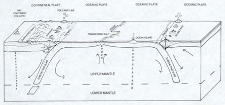
The creation and destruction of ocean floor. Ocean floor is created at mid-ocean ridges (shown in the middle of the diagram) and over millions to tens of millions of years pushes the continents (here, just one continent) aside. In some places (as along most of the coast of the Atlantic Ocean), the ocean and adjacent continent are part of the same plate, and the ocean plate does not drop down ("subduct"). Elsewhere, as shown here, the ocean and continent are on different plates, and the ocean plate, being heavier, subducts. In other areas, ocean plates subduct beneath other ocean plates (as shown on the right side of the diagram). Wherever subduction occurs, it produces volcanic activity 150 to 300 kilometers (about 100 to 200 miles) in the direction of the subduction. (Not all volcanoes owe their origin to subduction, however, and this diagram shows both mid-continent and ocean island volcanoes. The blobs below them are rising magma.) Note the long arrows. These indicate the churning of solid rock (some of it fully solid; some probably about the consistency of the stiffest taffy) in Earth's mantle, the presumed driving force for plate tectonics. (Fowler, 1990)
The actual creation of ocean floor at mid-oceanic ridges explains why the bedrock of the ocean floor is uniformly basalt, because it is basaltic lava which is extruded. In addition, the density of basalt (about 3.3 times the density of water) explains why the ocean floors should be relatively lower than the continents (which average about 2.8 times the density of water). The continuous creation (and destruction) of ocean floor also explains why the ocean floor is relatively young: after being produced at the mid-ocean ridges, it moves slowly away and eventually gets recycled down great trenches back into the interior of the planet. Thus the most ancient ocean crust, found in the northwestern Pacific, is at most only about 190 million years old. Much continental rock, by contrast, is over a billion years old, and some of it is considerably older.
Ocean basins, therefore, exist because they are continuously created, and because their rock is denser and heavier than other rock of the Earth's crust. Just as a more dense piece of wood floats lower in the water than a less dense piece does, so also does a large mass of more dense rock "float" lower on the surface of the Earth than does a large mass of less dense rock. The density difference between ocean basin rock and that of continents consequently produces a striking and instructive contrast between the average elevations of land and ocean floor, revealed in the hypsographic curve (hypso means altitude or elevation). The curve shows that the average height of the continents above sea level is about 3/4 kilometer (about 1/2 mile), while the average depth of the ocean floor is 3 3/4 kilometers (about 2 1/4 miles). Thus as long as plate tectonics continues on Earth, there will be ocean basins -- whether water is there to fill them or not!

Ocean basins are created, and they are also destroyed. Logically this has to be the case, because the Earth is not expanding over time, but remains the same size. After it is extruded at mid-oceanic ridges, the ocean floor basalt is carried by plate motion away from those ridges at a pace far slower (only 5 to 10 cm/2 to 4 inches per year) than that of a snail, cooling, contracting, and becoming even denser. Eventually, it drops down beneath other oceanic or continental plates, producing great submarine trenches up to 11 kilometers (6 1/2 miles) deep as it does. This process is called subduction, and it is the reason that the ocean crust is so much younger than that of the continents. Over the course of hundreds of millions of years, ocean crust is recycled.
Because ocean floor is created at rifts, and is destroyed in trenches, the size of an ocean basin depends on the relative balance of these two processes. In the case of the Atlantic, rifting and the production of ocean floor continues as it has for many tens of millions of years, and there is no significant subduction going on (exceptions being with the Antilles and the Scotia Arcs, the former in the easternmost Caribbean; the latter southeast of South America). Thus the Atlantic keeps growing slowly in size.
By contrast, the Pacific plate, which is the largest of several plates that comprise the floor of the Pacific basin, is being created in the eastern and southern Pacific and being subducted in the north and west. It is believed that this plate is being destroyed more rapidly than it is being created, so the Pacific Ocean (particularly the North Pacific) is actually steadily -- but slowly -- getting smaller.
If this process were to continue, or if the creation of Pacific plate oceanic crust were to slow or cease, the ocean basin could entirely disappear. That was indeed the fate of the ocean plate -- thousands of miles wide -- that once separated India from the rest of Asia. In the course of about 50 million years, the plate completely subducted (except probably for a tiny on-land sliver of ocean crust that often remains as evidence), and India collided with Asia, pushing up the Himalayas. Using specific rocks that originally formed ocean crust (called ophiolites), geologists can determine where other ocean basins which no longer exist once were.
The usual way that earth scientists illustrate how the plate tectonics process works is by the boiling soup analogy. Think of a thick soup boiling in a pot. The surface of the soup has places which are seething, and others where a foamy scud has formed and collected. The turnover of liquid in the seething places is extremely rapid,with boiling hot liquid rising to the surface, pushing outward, and dropping quickly back down (a heating process is known to physicists and geologists as convection). The seething liquid often seems to drop down near the places where the floating scud has accumulated. The scud itself exhibits relatively little movement, and may form rather large, frothy islands.
In the soup analogy the source of the heat is an electrical heating element or burning gas. For the Earth, the heat source is the core.

The core of the Earth is enormously hot (about 4300°C/7740°F). It is also under enormous pressure, which keeps the inner portion of the core solid despite the heat, though the outer core is liquid. The heat of the core, which is largely composed of iron, keeps the rocky layer above it -- a thick layer called the mantle -- hot, and keeps it in extremely slow, convective motion.

The scud is very much like the continents, accumulating gradually but changing little over time. The seething liquid, by contrast, is like the ocean basins, in a continual change. The soup analogy is a useful one but obviously has some serious limitations. Unlike the soup, the Earth has a thin but solid crust. But the soup clearly illustrates a basic geologic process called fractionation. The constant churning of the soup separates its lighter parts (that is, the lighter fraction) as scud, while the thick and heavy liquid (the heavier fraction) continues to seethe.
Another limitation of the soup analogy is that soup time is extremely short compared to geological time. The surface of the geological "soup" -- the tectonic plates, that is -- only moves a few inches per year at most. Moreover, there is very little liquid involved. Yes, lava does ooze out of rifts in the mid-ocean ridges, and spew or blast out of various types of volcanoes, but most of the movement of the earth's surface does not involve molten rock. Instead, most moving rock is either quite solid, or, down below where the temperatures are hotter, perhaps the consistency of stiff taffy. In fact, it is this very stiffness which explains why this sort of geologic movement is excruciatingly slow.
It is possible to understand how ocean basins formed by looking at how they are currently forming. (Surprisingly, perhaps, that process did not just take place in the geologic past, but actually does go on today!) The process starts when an elongated "crack" begins to open in a continental area. This "crack" geologically is called a fault, and usually is not a real physical opening in the earth, no more than California's San Andreas Fault is. There are lots of faults in the rocky crust of the Earth, some big (stretching a thousand or more kilometers -- 600 or more miles) and some quite small and local (just a few meters --yards), but the kind of fault which eventually produces an ocean basin is both rare and unusual. It is produced by forces quite deep in the earth, extrudes lava as it grows, and is beset by earthquakes throughout the millions of years of its existence.

A few million years after it has begun to open, it is a low-lying area usually surrounded by volcanic mountains or highlands. Being low-lying, it will fill with water. A glance at a map of eastern Africa reveals just such a landscape. All along the eastern border of Congo, and continuing along the eastern border of Malawi, there is a string of elongated lakes, smaller in the north (Lake Albert, Lake Edward, Lake Kivu), but considerably larger and longer to the south (Lake Tanganyika, Lake Nyasa). These freshwater lakes help define the long system of faults known as the East African Rift, because it is undergoing the geologic process known as rifting.
| ||||
From rift to ocean. The continent of Africa is slowly being torn apart along the East African Rift. The map on the left shows, in brown, the location of the rift. Note that many of the region's lakes have parallel brown lines. These represent the walls of the grabens in which the lakes lie. A graben, as shown in the diagram on the upper right, is a block of crust that has dropped down relative to the surrounding area. Grabens are produced as the crust is pulled apart and broken. Here the pulling is the result of the movement of East Africa plate toward the east, that is, in the direction of the Indian Ocean. (The current situation is similar to that shown in b of the previous diagram.) As rifting continues, this area will eventually resemble that of the Red Sea, shown in the diagram on the lower right. (The arrows indicate the direction of rifting.) Newly created ocean floor (basalt) is indicated by the stippling. (This situation is like that shown in c of the previous diagram.) (East Africa map from Duff, 1993, Figure 29.9, p. 672; Graben diagram is from Press and Siever, 1986, Figure 4-27, p. 93; Red Sea map is from Duff, 1993, Figure 29.7, p. 670.)
|


As the rifting process continues, the rift eventually meets the sea, and the freshwater is replaced by the saltwater of the ocean. Look further north on that map of Africa, and you will notice the Red Sea. Here we see the rifting process at a later, more developed stage. The sea is connected to the ocean; it contains salt water; it is longer and wider than the lakes of the East African Rift. On the other side of the globe, in North America, Mexico's Gulf of California displays rifting at a similar stage of development.
Such were the origins of the Atlantic Ocean. About 180 million years ago, what we now refer to as Africa and Europe were attached to and part of the Americas. Then rifting began, first in the north central area, and then, tens of millions of years later, in the south. The great S curve of the Mid-Atlantic Ridge had begun to create the ocean floor that would push Africa and Europe roughly 2500 kilometers (1500 miles) to one side, and the Americas roughly 2500 kilometers to the other. The Atlantic, currently about 5000 kilometers (3000 miles) across, continues to grow, adding a few inches to its width each year.
The plate tectonics process produces the major features of the ocean floor.
Adjacent to the continents are the continental margins; these are underwater extensions of the continents, composed of continental-type rocks rather than oceanic basalt, and largely covered with sediment washed into the ocean by the rivers of the land. Further from the continents lies the great deep of the ocean, called the abyssal plain (4 to 6 kilometers deep, or 2.5 to 3.5 miles), which, because it is so distant from the continents, gets rather little continental sediment, but often receives a slow, steady rain of organic debris from the overlying ocean.
Immediately off the edges of the continents lie the continental shelves, situated in relatively shallow water. In some places, such as the Atlantic coast of the Americas, the shelf is relatively wide, extending as much as about 100 kilometers (60 or so miles) out. In others, as along the Americas' Pacific coast, the continental shelf is relatively narrow, dropping off only 10-15 kilometers (6-9 miles) offshore. Some shallow seas (called epicontinental or epeiric seas), like Hudson Bay in North America, and the Ross and Weddell Seas on the edge of Antarctica, also are underwater portions of continents.
Geologically, the continental shelf is defined as that part of the continental margin that is between the shoreline and the continental slope (or, when there is no distinct continental slope, a depth of 200 meters). It is characterized by a gentle downward gradient of 0.1°. Shelves are not only adjacent to continents and under relatively shallow water, but they also share the general geology of the continents: rock compositions are similar, granitic in overall composition, and of the same general age.
Further from the continent is the continental slope, the more distant portion of the continental margin. The slope tends to be fairly narrow compared to the continental shelf, but it lies deeper and has a gradient of about 3 to 6%. Though steeper than the adjacent continental shelf, and even occasionally as steep as 15%, these gradients are certainly not precipitous. The continental slope drops from the continental shelf (at a depth of about 200 meters, or 600 feet) to depths of several kilometers. (The slope and the "passive basins" of the same depth are the parts of the ocean where, as we will see, methane hydrates are found, because temperature and pressure conditions are right. With hundreds to thousands of meters [600 to about 6500 feet] of water overlying them, and with the frigid temperatures at such depths, conditions allow the formation and preservation of these exotic, icy substances.)
Still further out there may be a continental rise, with a generally smooth topography and a gently inclined gradient of from 0.05% to 2.5%. The continental shelf and slope may be incised by submarine canyons, particularly in areas where large rivers now or in the geologically recent past have cut into submarine sediments as they deliver their waters to the ocean. The continental rise represents the area of the ocean floor where the remaining muddy sediment derived from rivers and continents (that which has not been left behind on shelf or slope) is deposited. Rises are common to passive margins (as along the Atlantic: see below), but not to active ones (as along the Pacific Northwest).
The deepest parts of the ocean basins, however, constitute a striking contrast to the parts of the oceans which are shallower and closer to land. They are extremely deep, dark, and intensely cold. Because these ocean basins are generally flat, and what topography there is is at most gently inclined, they are referred to as abyssal plains. On average, they are several (four to six) kilometers deep. Their extreme depth provides no natural light. Their water temperatures are about or only slightly above 0°C (32°F). In fact, their water may actually be below the freezing point of water -- pure water, that is. Because salt lowers the freezing point of water, highly saline seawater can remain liquid at temperatures down to about two degrees below zero Celsius (that is, to almost 28.4°F).
These, then, are the major features of the ocean floor: the rifts/ridges, which actually produce the bedrock of the ocean basins, the deep floor itself, the zones where subduction is taking place, and the continental margins. Continental margins, however, are not everywhere the same. Where continents are overriding the subducting oceanic plates, there is a good deal of earthquake and volcanic activity. These margins are called active margins, and where they exist, the continental margins are narrower. This is why continental shelves on the Pacific coast of the Americas are less wide than those of the Atlantic coast. Offshore they have (or in the geologically recent past, did have) trenches where ocean crust is (or recently was) subducting.
The continental margin of Northwest Coast of the US is an example of such an active margin. Much of the California coast is prone to earthquakes, both from the San Andreas Fault and many others. To the north is a major subduction zone, just off the northern California coast and along those of Oregon, Washington, and British Columbia. This coast can have rare, but quite powerful quakes. Inland from the coast is the Cascade chain of volcanoes, stretching from Mounts Lassen and Shasta in the south to Mount Baker near the Canadian border. These features of the West Coast are the consequence of the continuous movement of the North American continent as it overruns the Juan deFuca plate; the movement churns up sediments along the coast but keeps the margin narrow.
| Andean-type continental margin, also referred to as an active margin.Named after the Andes Mountains of western South America, another example is that along the coasts of northern California, Oregon, Washington and British Columbia. There, an ocean plate (the Juan deFuca plate) drops down ("subducts") beneath the North American continent, producing volcanoes (the Cascade range). (Moores and Twiss, 1995, p. 46) |  |
By contrast, the continental shelves along both sides of the Atlantic (including the Americas, Europe, and Africa) are relatively wide. Once rifting and the creation of the Atlantic Ocean basin had pushed the continents some distance to each side, the continental margins became quiet, or passive. Although there is some occasional earthquake activity along the North American continental margin (there was a major quake in the Boston area in the early 18th century, for example, and another in Charleston, South Carolina in the late 19th), such activity is rare. And, obviously, there are no volcanoes.
| Atlantic-type continental margin, also called a passive margin. This cross-section through land and ocean reveals that no subduction or subduction-related volcanism is occurring. Continental curst and ocean crust are part of the same plate. The "intrusions and extrusions" are remnants of the rifting activity which produced the ocean basin. (Moores and Twiss, 1995, p. 45) |  |
Plate tectonics is the central integrating concept of geology, just as evolution is the central integrating idea of biology. I employ the phrase "central intergrating concept" rather than the term "theory" because that term is both misunderstood and abused. The term "theory" is misunderstood because it leads some people to think that something described as a "theory" is a mere air-headed idea without foundation in reality or facts to back it up. Nothing could be further from the truth. Moreover, the use of the term "theory" allows opponents -- who almost universally have no or little knowledge of the myriad facts that support the concept -- to disparage theories as without basis. Both plate tectonics and evolution have enormous quantities of evidence to support them; moreover, they explain things which would simply be without explanation otherwise.
At times the continents that existed have been relatively dispersed across the face of the globe, as they are today. At other times, they have amalgamated into super continents, containing the equivalent of several of today's continents. On occasion, there have even been mega continents, which comprise in one continuous mass almost all the continental material on the Earth's surface. Such was the case in the Permian, when a major feature of global geography included a global mega continent we call Pangea, that is, "all-the-earth."
This mega continent was comprised of two immense landmasses ("super continents"), one composed of what is now Antarctica, Australia, the Indian subcontinent, Madagascar, Africa and South America and called Gondwanaland, after part of India, Gondwana, the "land of the Gonds" [so Gondwanaland is actually redundant, meaning land of the Gonds land]. (The Gond kingdoms of Madhya Pradesh -- the "Middle Province" of central India -- flourished from about the 12th century on, and Gondwana was a powerful state in the 16th century.) The other immense landmass consisted of what is now North America, Greenland, Europe and a large part of Asia, and is referred to as Laurasia. This name derives from a combination of the Laurentia (northeastern Canada), geologically the most ancient portion of North America (and often referred to as the Laurentian or Canadian Shield) with Asia.
These two landmasses partially enclosed a large tropical ocean, centered on the equator, called the Tethys. Bounding the Tethys to the east were the North China and South China blocks, great islands somewhat like today's Greenland or New Guinea. Within the Tethys, north of Gondwana, was a string of large islands (comprising today's Turkey, Iran, Afghanistan, and Malaysia) that were part of the largely submerged Cimmerian continent. (The Lhasa Block, a large island that eventually became much of Tibet, may have been part of Cimmeria, or may have followed it: Wignall and Twitchett, 2002.) The Cimmerian continent had detached from Gondwana earlier in the Permian (or perhaps the Late Carboniferous), and had begun moving across the Tethys. The splitting of Cimmeria from Gondwana was caused by the development of the "Tethian rift," a mid-ocean ridge, which was eventually to transport Cimmeria all the way across the Tethys and attach it to Laurasia. (The Tethian rift, because it produced ocean floor, actually created a new ocean, labeled the Neo-Tethys, and helped destroy an older one, called the Paleo-Tethys, which subducted beneath Laurasia.)
Surrounding the entirety of Pangea as well as the North and South China blocks was an immense ocean, a hemisphere-sized ocean (therefore larger than today's Pacific): the "all-ocean," Panthalassa. This was the largest ocean of the Phanerozoic. Some paleoceanographers (those who study ancient oceans) believe that Panthalassa was a stagnant, highly stratified ocean, perhaps largely anoxic (lacking in the dissolved oxygen needed by all animals and other organisms): "dead," except for its upper reaches (Wignall and Twitchett, 2002). The evidence for this anoxic, stratified ocean, however, comes from a single locality (Isozaki, 1994; 1997a), and that source has indicated that the anoxia may have been the consequence of events at the end of the Permian (Isozaki, 1997b), rather than having been an ongoing condition of this ocean. Certainly careful studies of the organisms in the ocean waters off the northwest coast of Pangea reveal no such anoxia before the end of the Permian (Beauchamp and Baud, 2002).
The Tethys, with just a few relatively narrow passages (up to about 1000 kilometers/600 miles wide) connecting it to the larger ocean (Panthalassa), may have had more restricted circulation, although today's Mediterranean, with only a single outlet through the Strait of Gilbraltar, exchanges large quantities of water with the adjoining Atlantic. The evidence for anoxia in the Tethys, at least during the last million years or so prior to the end of the Permian (Wignall and Hallam, 1992; Twitchett and Wignall, 1996; Wignall, 1995; Kershaw, 1999) is somewhat better than for Panthalassa. Being a warm and largely enclosed ocean would have made the equatorial Tethys more susceptible to oxygen depletion (warm water holds less dissolved gas) than Panthalassa, which stretched from pole to pole, and undoubtedly was recharged with oxygen in its colder regions. Before the last days of the Permian, however, it seems likely that the Tethys was quite a normal (unstratified, oxygenated) ocean, and that Panthalassa also likely was so right to the very end.
Large landmasses produce extreme weather in their interiors. Whereas coasts tend to have climate conditions which are milder due to the moderating effects of nearby oceans, continental interiors have temperatures which are both hotter in summer and colder in winter than those on the seacoast. The midwestern regions of Canada and US, for example, can get quite hot in summer, producing violent thunderstorms and tornadoes. The same areas can be brutally cold in winter, with temperatures descending regularly into the minus thirties (°C, = minus twenties °F) in Missoula, Montana and into the minus forties (°C or °F) in Edmonton, Alberta. By contrast, Ketchikan, Alaska, though further north but on the Pacific coast, never has such extreme temperatures. The coldest spot on Earth during the Northern Hemisphere's winter is frequently around Yakutsk in the interior of Siberia, rather than places further north.
Large landmasses not only have climate extremes in their interiors, however, they also generate weather extremes on their periphery. The monsoons that bring seasonal rains to southern Asia, for example, are largely the creation of low pressure systems that form over the Asian continent. The heat of summer in the interior of Asia warms the air, causing it to rise and surface air pressure to drop. This low pressure region pulls in moisture-laden air from surrounding oceans, drawing major storms to the Asian coasts. Because of the great size of Pangea, it seems likely that its monsoons were proportionately greater than today's.
The surface layer -- about a hundred meters (yards) deep -- of Panthalassa would have been well stirred by such tempests, particularly near the shore. Wind generated waves would also have helped mix the surface layer, bringing nutrients to the surface and oxygen into the water. The size of waves on a given body of water is the uninterrupted expanse over which the wind can blow, a dimension known as fetch.
The reason that waves on a small lake are smaller than waves on a larger lake, other things being equal, is that the smaller lake provides less fetch for waves to build. On Panthalassa, fetch would have extended for half the globe, allowing wind waves to build to considerable heights. In addition, great oceanic swells (ultimately the consequence of the rotation of the Earth), known as Rossby waves, may pump nutrients from deeper layers to the surface of the ocean and thereby feed photosynthetic algae. The churning of the upper regions of the ocean by this mechanism has been labeled "the Rossby Rototiller" (Siegel, 2001).
Toward the end of the Permian, two major volcanic events took place. One was an episode of significant pyroclastic volcanism in southern China. Pyroclastic volcanism is a particularly violent kind of volcanism, exhibited today around the "Ring of Fire," the lands which border the Pacific Ocean. In the Andes of South America, the Cascades of western North America, the Aleutian Islands of Alaska, the Kamchatka Peninsula of the Russian Far East, in Japan, the Philippines, Indonesia, and many volcanic islands of the South Seas, we regularly see highly explosive volcanoes called stratovolcanoes producing devastating eruptions of ash and lava.
In recent decades, we have seen such eruptions at Mount St. Helens in the state of Washington, Mt. Pinatubo in the Philippines, and Mt. Unzen in Japan. Stratovolcanoes, when they are not in their eruptive state, are often beautiful, symmetrical mountains, draped with evergreen forests on their slopes and capped with brilliantly white fields of snow and ice. When they erupt, however, they produce huge dark clouds of ash and gas which rain destruction on nearby communities. Some of these immensely hot ash and gas flows, called pyroclastic flows, race along at speeds of greater than a hundred miles per hour, hugging the ground, searing and suffocating all living things they encounter. Stratovolcanoes also erupt blobs of molten lava which fall as rocky bombs on areas close by. The heat produced during the eruptions of stratovolcanoes can melt their snow and ice fields, sending floods of water, mud, and rock (called lahars) surging down nearby river valleys. These lahars may carry volcanic debris a hundred or more kilometers (about 60 miles) from its source.
Particularly violent stratovolcanic eruptions can actually blast away the summits of their peaks, as happened with Mount St. Helens. Even more violent was the eruption about 10,000 years ago of Oregon's Mt. Mazama, which blasted away most of the mountain. Mount Mazama exists no longer; its rim forms the retaining wall of the body of water we now call Crater Lake. Yet more was the 1883 eruption of the Indonesian stratovolcano Krakatoa. Tens of thousands of Indonesians perished in the tsunamis it produced; the sound of its explosion was widely heard around the world. Thousands of others in the Roman cities of Pompeii, and Herculaneum died in the pyroclastic clouds unleashed in 79 CE during the eruption of the stratovolcano Vesuvius. The 1902 eruption of Mount Pelée on the Caribbean island of Martinique killed almost 30,000 people, including the entire population of the city of St. Pierre: when the pyroclastic clouds passed, a single human being was left alive in the city prison.
Despite such violence, however, stratovolcanic eruptions do not cause mass extinctions. They can cause climate effects, but even those are limited and short-term.
The pyroclastic eruptions of South China stratovolcanoes about 250 million years ago, therefore, are extremely unlikely to either have caused the end-Permian extinction, or even contributed in any significant way to that event. This is because, despite the fact that stratovolcanoes usually exist in long chains or arcs rather than as isolated volcanoes, they don't erupt all at once. Usually one volcano in a chain will erupt, then, some decades later, a different one. This is how the chains of volcanoes in Indonesia, or the Andes, or the Cascades behave, so our evidence is good. In addition, though each eruption does cause significant harm and disruption to nearby living things -- demolishing forests and their inhabitants, for example -- the effects are generally quite local and the affected organisms are likely to inhabit ecologically similar areas elsewhere in the volcanic chain. The likelihood of more than a few species -- if that -- going extinct in a major volcanic eruption, therefore, is very minimal.
There is, however, a second kind of volcanism that occurred about 250 million years ago which could have had much greater consequences. Near the end of the Permian, in northern Siberia, was the largest volcanic episode of the Phanerozoic. Instead of being produced by ordinary volcanoes, the eruptions likely occurred through great cracks or fissures, spilling huge quantities of syrupy, basaltic lava out over vast areas of the Siberian countryside.
Fissure eruptions are an uncommon type of volcanic eruption, generally unfamiliar even to those knowledgeable about other kinds of eruptions. The most recent large fissure eruption took place in southeast Iceland in 1783-84. There the Laki (Kagagigar) eruption ripped open a crack in the surface some 25 kilometers (15 miles) long, and sent hot, fluid basalt a distance of some 45 kilometers (27 miles). The lava eventually covered about 500 square kilometers (about 200 square miles; Duff, 1993, p. 210-11).
 | 
Laki fissure eruption. The map shows the areal extent of the eruption. The photo looks southwest along the fissures, with a cinder cone in front. (Duff, 1993, p. 210-11)
|
The eruption produced fluorine-laced ash, which contributed to crop failure and to the deaths of about 80% of Iceland's sheep population, largely from fluorine poisoning. The ensuing famine and fluorine poisoning led to the starvation of some 10,000 people, about 20% of Iceland's total population (Fisher, 1997, p. 170; Thordarson and Self, 2003). An acidic atmospheric haze created by the eruption reached the cities of northwestern Europe, where it was observed as a "dry fog" by the American ambassador to France, Benjamin Franklin (Brands, 2000, p. 626). (A similar acid fog is apparently a feature of the Hawaiian volcano Kilauea, where its acidity has created the adjoining Kau Desert: Schiffman, 2006).
The Siberian Traps fissure eruptions of 250 million years ago were accompanied by considerable pyroclastic activity. About 20% of the material erupted by Siberian Traps volcanism was in the form of pyroclastic debris, which produces distinctive rocks called tuffs. Some of this pyroclastic volcanism may have been of a particularly devastating variety called caldera explosions, where an area up to perhaps thirty miles in diameter suddenly settles into an enormous subterranean magma lake, lofting ash high into the atmosphere and carrying it far from its source. Ash from the Long Valley Caldera (California) explosion, which happened about 730,000 years ago, distributed ash over about two-thirds of what are now the contiguous forty-eight states. Caldera eruptions associated with today's Yellowstone, going back some 17 million years, regularly dropped ash over large parts of the country.
But fissure eruptions like those in Siberia at the end of the Permian extrude much of their output as fast flowing lava, much as do today's Hawaiian volcanoes. The thin, syrupy basalt flows in sheets across relatively flat terrain, eventually cooling into what are called "large igneous provinces" or LIPs. Much of the Columbia River valley in Idaho, for example, is occupied by such a LIP, providing farmers with fertile soil for potato crops and tourists with the Craters of the Moon National Monument.
LIPs are characterized by repeated, intermittent basalt flows, which settle and cool on each other like layers on a cake. These flows can look like giant steps, giving them the Dutch name "Traps," meaning steps (Alvarez, 1997, p. 168, fn. 24). In the northwest of India lie the famous Deccan Traps, which erupted about 65 million years ago -- roughly the same time as the end-Cretaceous extinction that killed the dinosaurs -- and have helped confuse the issue as to that extinction's cause (though it now seems to most scientists that the Deccan Traps eruption played no role in that extinction). Similar LIP-produced step-like formations may be found in Washington state's Grand Coulee area.
 |
| A large igneous province (LIP) in Greenland. The layers in this flood basalt formation (presumably part of the widespread North Atlantic Igneous Province, or NAIP) are horizontal, which is the consequence of numerous thin, syrupy flows of basalt, each having cooled over one previously deposited. (Duff, 1993) |
There is much about LIP's which we don't know, because geology of necessity relies greatly on the principle that "the present is key to the past." In other words, geologists come to understand much of what occurred in the past by seeing similar processes occurring today. But if a geologic event is sufficiently rare (or even unique), it may be difficult to understand all the consequences of that event. Thus, while we can examine the consequences of the eruptions of ancient stratovolcanoes because one or another present-day stratovolcano is always erupting (actually, about twenty are erupting worldwide at any given time; Simkin and Siebert, 2000, cited by Wright and Flynn, 2004), we have no contemporary LIP eruptions to compare with the ones we know took place in geologic time. Today's closest similar eruptions may take place in Iceland, but as Iceland's volcanism is part of the general mid-oceanic ridge system's extrusive activities, it may not make for an appropriate comparison. Nonetheless, it is clear that LIP's are produced by the eruptions of huge blobs of mantle magma that have accumulated just below the crust of the Earth.
| Rising from the Deep, 1: The Pennsylvanian-Permian Reversed Superchron, 312-262 Ma It is possible, however, that the huge amount of material erupted by the Siberian Traps was related to a strange occurrence in the tens of millions of years that preceded the end of the Paleozoic. The Earth's magnetic field, which compasses rely on to provide an approximate direction for north and south, is actually quite unstable over long periods of geologic time. Not only do the positions of the magnetic poles move slowly about (a characteristic known as polar wander), but they also occasionally and spontaneously reverse direction: north becomes south and south, north. Nothing happens to the planet during these times; the Earth itself does not abruptly flip over, for example, but the polarity of its poles suddenly shifts. The geophysicists who study such matters trace these polarity reversals to random variations in the molten outer core of the planet. (Those geophysicists who study the history of Earth's magnetism are properly called paleomagnetologists, but some of them enjoy labeling themselves paleomagicians.) When lava erupts from volcanoes or along the mid-oceanic ridge, the iron particles in the lava, though initially pointing at random, orient themselves toward the poles like tiny compasses. Upon cooling, they therefore record in the rock the orientation of Earth's magnetic field at the time. When the tiny iron compasses in the rock point in the direction of today's north pole, the poles are said to exhibit normal polarity; when they point south instead, the poles are said to be reversed. Using sophisticated equipment, the periods of normal and reversed polarity are clearly seen in the rock record. Despite the use of the term normal to describe the current polarity of the Earth's magnetic field, however, there is nothing "abnormal" about reversed polarity: it is just as common in the rock record as "normal" polarity. Polarity reversals occur every several thousand to many millions of years. When the periods of magnetic stability are relatively short in length they are referred to as chrons, but the few that lasted for extreme lengths of time are called superchrons. Towards the end of the Paleozoic, there was period when the magnetic polarity of the planet was reversed for some fifty million years (from 312 to 262 million years ago), the longest known period of magnetic stability of the Phanerozoic. This interval is known as the Pennsylvanian- Permian reversed superchron, for the two geologic periods during which it occurred. (The Pennsylvanian Period is the younger portion of the Carboniferous, which is divided into the Mississippian -- about 360-320 Ma -- and the Pennsylvanian -- about 320-290 Ma.) Something was clearly somewhat different down in and near the planet's outer core. We don't know what that something was, but it has been suggested that it had to do with a disturbance at the boundary between the outer core and the overlying planetary layer, the mantle. It has been postulated that, on occasion, large blobs of mantle rock, heated by the fierce heat of the core at the core-mantle boundary, may rise through the mantle and cause eruptions on the Earth's surface. (Some have even suggested that the material at the bottom of the mantle, where the suggested blobs may originate, may be the remnants of old tectonic plates that, once subducted, ultimately drifted down that far.) It is therefore possible that a great blob of material accumulated at the core-mantle boundary for the fifty million years of the Pennsylvanian-Permian reversed superchron, stabilizing the planet's magnetic field. When it became sufficiently buoyant, it lifted off and eventually made its way to the planet's surface, where it erupted as the Siberian Traps. This proposal thus explains both the existence of the Phanerozoic's longest period of magnetic stability, why it came to an end, and the origin of the Siberian Traps volcanism. |
| How We Know Where the Continents Were How do we know what the configuration of the continents and oceans was like 250 million years ago? One major way is by the use of paleomagnetism. As lava is erupted, and iron-bearing particles orient themselves according to the direction of the magnetic poles, those particles record the position of the continent relative to Earth's magnetic field. The iron partilces in each successive lava flow, upon cooling, do the same. As a continent moves, therefore, the lava flows from its volcanic eruptions record the position of the continent at the time of eruption relative to the magnetic poles. Using these "frozen compasses," it is possible to trace the movement of a continent, or piece of continent, as it has moved across the surface of the planet. The work is complicated and difficult (magnetic reversals being one complicating factor), but by carefully examining these natural compasses to determine the original orientation of the ancient lava flows, scientists can determine the ancient positions of continents -- or pieces of continents. Other evidence is also used. Well before the discovery and use of paleomagnetism, some geologists were struck by the similarity of fossils on continents that are now quite distant from each other. Similar Permian-age land plant fossils, for example, can be found in India, Madagascar, South Africa, South America, Antarctica and Australia, all places now separated by many thousands of kilometers (several thousand miles) of ocean. To explain these similarities, geologists were forced to posit some sort of physical connection (that would allow the movement of terrestrial organisms) between these areas. For years geologists relied on the idea of "land bridges," like the famous Bering Strait Land Bridge, across which the original human inhabitants of the Americas crossed into the western hemisphere from Asia. But unlike the Bering Strait Land Bridge, which really did exist, and which was the result of the lowering of sea level during the most recent ice age, there was no evidence for most other proposed ancient land bridges. As we now know, large chunks of land do not spontaneously pop up out of the ocean when needed to allow the movement of terrestrial organisms from one place to another, and then conveniently disappear beneath the waves. Rather -- and probably even more amazing than the appearance and disappearance of purported land bridges -- the continents and pieces of continents themselves do move. In the past, continents which are now widely separated were actually joined together, permitting the relatively easy movement of terrestrial organisms from one place to another. The similar Permian plant fossils of India, Madagascar, South Africa, South America, Antarctica and Australia, for example, can now be explained by the fact that for more than a hundred million years, these landmasses were all part of the supercontinent Gondwana. Thus one line of evidence of previous connections between continents is the similarity of their fossils; another is the similarity of their rocks. |
The Permian was the final geologic period of the Paleozoic Era (543 to 250 million years ago). Named for the medieval kingdom of Permia, which occupied a small region between the Ural Mountains and the Volga River (Duff, 1993, p. 87) around what is now the city of Perm, Russia, where strata from this period are prominent, the Permian lasted from about 290 until about 250 million years ago. In some ways, the creatures of the Permian were beginning to resemble those of today. In other ways, they were very different.
On the land, there were forests. These forests were not like the forests of the preceding geologic period, the Carboniferous, during which fern and lycopod trees occupied swampy tropical lowlands and had begun to move into drier uplands. (Though there are no longer any lycopod trees, lycopods are still around, rising to the height of just a several centimeters (a few inches) above wet forest floors. Referred to as club mosses, they are not mosses at all, and an alternative common name, ground pines, gives a better sense of what these plants look like.) These trees became the source of much of the world's coal, conferring the name Carboniferous upon the period.
The forests of the Permian were different. Adapted to a drier world, Permian forests still provided the raw materials for present-day coalfields, but their constituent trees had changed. There are not any cycad trees around today, though their unusual descendants, the cycads, are with us yet. In appearance they are similar to ferns, though their fronds are much larger, and generally tougher and drier. During the Permian, cycad trees were a major component of forests, as were the conifers -- cone-bearing trees that were the ancestors of today's conifers, pines, firs and spruces.
Permian conifers apparently evolved in the northern regions of Pangea, in the supercontinent called Laurasia, and they had not yet spread to the southern super continent, Gondwana. In Gondwana, the broad-leafed Glossopteris and its relatives were the dominant trees. The Permian forests contained none of the deciduous flowering trees of today's forests -- those trees hadn't evolved yet -- but the northern coniferous forests would have seemed vaguely familiar.
In the forests and on the plains of the Permian world were vast numbers of a wide variety of reptiles, which had largely replaced an earlier (Devonian-Carboniferous) amphibian fauna. The giant insects of the Carboniferous -- millipedes with bodies up to half a meter (a foot and a half) in length, and dragonflies with three-quarter meter (two and a half feet) wingspreads -- were gone. But there were numerous lineages of reptiles.
Reptiles have a general competitive advantage over amphibians. This advantage is not sufficient to drive amphibians from every possible habitat: after all, there are still plenty of amphibians in the world, hundreds of millions of years since the Permian. Newts, salamanders, frogs and toads are quite plentiful, but, of course, they all need water or highly moist conditions in which to lay their eggs. But reptiles came up with an evolutionary innovation which freed them from that requirement: the amniotic egg. This egg, in essence, carried wet conditions with it. Having a relatively hard shell, it was resistant to drying, and allowed reptiles to move to areas like drier, upland forests, that were generally inhospitable for amphibians.
During the Permian, some reptiles also began to evolve a more efficient system of locomotion. Early reptiles, like many amphibians, possessed sprawling limbs. But some reptiles evolved the ability to place their limbs under their bodies, first the hind limbs, then later, the front. The fully upright stance was an evolutionary development that took many tens of millions of years. But as the Permian progressed, having upright limbs beneath the body became common, particularly among the more successful lineages of reptiles. This position of the limbs permitted the reptiles more rapid and efficient locomotion, increasing their effectiveness as predators.
Many reptiles were not predators, however. Unlike the amphibians, some reptiles developed the ability to process large amounts of vegetation. More efficient jaw muscles and more specialized teeth -- or, in some cases, horny beaks like turtles -- allowed them to crop and chew plant matter. The girth of some of these herbivorous reptiles testifies to the large guts they employed for digesting large quantities of vegetation, and their robust limbs indicate the physical strength required to transport these heavy creatures around.
Another evolutionary innovation freed many lineages of reptiles from obligatory cold-bloodedness. Most reptiles, like many other organisms are cold-blooded, that is, their body temperatures are just about the same as the world around them. This limits their ability to be up and about during the cooler hours of the day, and restricts them to warmer climates. From the early Permian on, however, various lineages of reptiles evolved solutions to this limitation. Most astonishing, perhaps, were the sails that were developed by particular herbivorous and carnivorous reptiles.
Labeled sails because that is what they look like, these features were actually constructs of vertebral bone, blood vessels, and skin that rose from the backs of reptiles like Edaphosaurus (an Early Permian herbivore), and Dimetrodon (a famous Early Permian carnivore). Most paleontologists believe that the primary function of these sails (there may have been additional functions, like attracting potential mates) was to catch the rays of the sun. This would allow their possessors to warm up quickly in the morning, and get on with the day's business earlier than their cold-blooded cousins. They would have also been able to stay more active during the day, and radiate away heat more effectively on hot days. Some paleontologists believe that these reptiles with solar panels may also have had systems that shut down most circulation from the sails during cooler periods, avoiding heat loss.
The sail system may have been just one of the ways that reptiles employed in attempting to regulate their body temperatures. In addition to the lineages that led to today's reptiles -- snakes, lizards, alligators and crocodiles, and turtles -- one highly successful reptile group -- the therapsids -- eventually led to the mammals. The therapsids were so successful, in fact, that they are estimated to have left behind about 90% of terrestrial vertebrate fossils in the Late Permian. Huge herds of these animals probably browsed the vegetation of southern Africa and elsewhere in Gondwana.
One key to their success may have been their thermo regulatory ability, the ability to regulate their body temperatures. Whereas reptiles have scaly skins, which provide little insulation, some therapsids may have evolved body coverings of hair. Though we do not have evidence they wore fur coats, some therapsid fossils do exhibit snout pits, dimples in facial bones that may have accommodated those particularly sturdy hairs we know as whiskers. If these therapsids had whiskers, they likely had some body hair as well. Later therapsids may also have been developing systems of internal thermo regulation, akin to mammalian warm-bloodedness.
While the mammal-like reptiles were thriving, other lines of reptiles were also evolving. Some of these reptiles would eventually return to the seas, and dominate the Mesozoic oceans as plesiosaurs and ichthyosaurs. Another reptile line would lead to the large and fearsome carnivorous monitor lizards of today's world, and also to the mosasaurs, another major group of large Mesozoic marine reptiles. All of these marine reptiles -- plesiosaurs, ichthyosaurs, and mosasaurs -- would meet their fates at or near the end of the Cretaceous.
The last reptile lineage worth noting here was that which eventually produced the crocodiles and alligators. This reptile line would lead, in the Late Permian and Triassic, first to the Archosauromorphs -- literally, the ruling lizard forms -- and then to the Archosaurs, the "ruling lizards" themselves. This descendants of this line of reptiles would take over the position of dominant terrestrial vertebrates from the mammal-like reptiles during the latter part of the Triassic. They would also put at risk those mammal-like reptile lineages that led, hundreds of millions of years later, to ourselves and all modern mammals. These archosaur descendants were literally the terrible lizards, the dinosaurs. They would dominate the land for over a hundred and thirty million years.
In the two Permian oceans, Panthalassa and the Tethys, fish and sharks were the dominant vertebrates. Whales and dolphins -- marine mammals -- were hundreds of millions of years in the future; after all, even true mammals were yet to evolve. But the armored fish -- fish with great bony plates on their heads -- of the earlier Paleozoic, particularly the Devonian, were a distant memory. Though the fish and sharks of the Permian oceans were not of types around today, their forms are familiar.
Not so the ammonites, which superficially resemble today's chambered nautilus of the southwestern Pacific. These often large, coiled mollusks were highly sophisticated organisms, quite unlike their distant cousins, the clams and oysters. Like their closer cousins, the octopi, ammonites were smart and stealthy predators. They hunted and consumed fish, and competed with larger fish for smaller prey.
On the shallow ocean floors of Permian continental margins, trilobites were declining in number and variety after thriving for hundreds of millions of years. Sponges were plentiful, and there were carbonate reefs, though not the structurally sophisticated reefs of the present. Two types of corals existed, the cone-shaped rugose corals, and the flatter tabulate corals, though neither were major reef constituents.
The single-celled marine organisms known as foraminifers (referred to by most scientists as forams) were flourishing, both in the water column and on the seafloor. These organisms construct shells of calcium carbonate (like many sea creatures, clams, for example) or build them by gluing together grains of sand and bits of shell. Like amoebae, they have pseudopods (literally, "false-feet": extensions of the cell body) for locomotion and feeding, and consume both phytoplankton (plant-like forms of plankton; they produce their own food) and zooplankton (animal-like forms of plankton; they consume other organisms). (Plankton is the name for organisms which passively drift in the sea. Though they may have limited means of locomotion, for the most part they are just carried along by ocean currents.) One type of Permian foram, the fusulinids, was especially notable. Perhaps with the cooperation of symbiotic algae, some fusulinids reached the size of large grains of rice.

The oceanic food chain, like today's, must have ultimately depended on photosynthetic organisms. Many of these organisms were relatively simple and provided fodder for the zooplankton. Lacking hard parts, they left no evidence of their existence beyond possible organic residues on the ocean floor. Other photosynthesizers were more complex, and constructed minute shells of silica (glass). These photosynthesizers, the diatoms, have been extremely important in Earth's oceans, and continue so today.
The end-Permian Extinction
The magnitude of the extinction at the end of the Permian is unparalleled in Earth's history. Although back in the dim reaches of time, during the Precambrian, there may have been extinctions which took out a higher percentage of individuals, and a higher percentage of the then existing groups of organisms, the fossil record for that time is extremely spare, and extinction events almost impossible to recognize. During the eon of visible life (the Phanerozoic), however, the geologic record has provided abundant fossils, making it possible to identify major extinction events. Based on the fossil evidence, therefore, the extinction at the end of the Permian exceeds all other mass extinctions of the Phanerozoic.
(The end-Permian extinction may have come in two stages, one several million years earlier than that of the final catastrophe. Some scientists consequently believe that the end-Permian was actually a kind of "double extinction," with a smaller but nonetheless major extinction coming perhaps five million years before the ultimate event [see, for example, Stanley and Yang, 1994; Racki, 2003]. This extinction came at the end of the next-to-last geological interval [in this case called an "age"] of the Permian, and is generally referred to as the end-Guadalupian extinction. However, it is clear that the devastation of this earlier event was not of the same scale as that at the actual end of the Permian, and it is that extinction which is our focus.)
According to some scientists (for example, Stanley, 1987, p. 99), the forests and terrestrial plants of the Permian are the group of organisms that best survived the end-Permian extinction. Plants do tend to be more resistant to extinction than other organisms, partly because they reproduce by means of spores and seeds, which can survive long periods of unfavorable climate conditions like drought. Plants also frequently are able to reproduce from roots or subsurface stems and tubers, which because of their location underground enjoy some protection from events on the surface. Consequently, terrestrial plants have been considered as relatively invulnerable to mass extinction (Knoll, 1984).
But terrestrial plants seem to have been hard hit at the end of the Permian, according to some systematic surveys of plant groups before and after the extinction. Over an extended period of millions of years, the number of terrestrial plant families dropped almost 50%, and the total number of species fell about 20% (Knoll, 1984, Figures 1 and 2). This represents the only significant loss of plant diversity in the entire Phanerozoic (there was a lesser loss in the Late Devonian).
More detailed studies show that many specific plants did become extinct at the end of the Permian; these included, most notably, the broad-leafed, small- to medium-sized tree Glossopteris, which had been ubiquitous throughout Gondwana. Plants related to and associated with Glossopteris (together called the Glossopteris flora) disappeared from many parts of the world. In North China, a pteridophyte (fern, horsetail and lycopod) flora replaced the conifers, while in South China the number of species of spores and pollen fell by almost one-half. This pattern was apparently worldwide, with similar changes reported from Greenland, Poland, Hungary, Pakistan, Madagascar, and Australia. The Early Triassic flora that replaced that of the Permian included far fewer species (Yang, 1992).
 | Glossopteris. This tree and its close relatives were dominant members of Permian forests, but they were devastated by the end-Permian extinction. Nonetheless, some species did recover, and Glosssopteris trees were present in the Triassic, and some may have survived into the Jurassic. Some Glosssopteris trees stood about 4 meters (13 feet) tall. Artists' renderings of this tree vary considerably, however: Compare this drawing to that in Appendix 2. Part of the difference in the depictions can undoubtedly be traced to the fact that different parts of the tree (leaves, pieces of branch, trunks) are found separately, and the artist must reconstruct how they were actually assembled. (Stewart and Rothwell, 1993, Figure 26.6, p. 372) |
In the Sydney area of southeastern Australia, the plant extinction seems to have been particularly devastating: 97% of the Late Permian leaf species died off (Retallack, 1995). Though spore data from this area indicates that a higher percentage of plants may have survived than is indicated by the leaf fossils, it is clear that the change in vegetation was sudden and profound. Within only a short time, perhaps only a few thousand years, the Glossopteris flora had been replaced by an Early Triassic flora (Retallack, 1995). And there is no question that end-Permian plant mortality must have been high: fungi, which live on dead plant matter, did quite well at the time of the extinction.
We know this from the sudden increase in the numbers of fungal spores preserved in the fossil record. In fact, more than 95% of the spores found by one study at the boundary between the Permian and Triassic Periods are fungal. This "fungal spike" was worldwide in extent: similar evidence has been found in North America, Greenland, Europe, Asia, East Africa, Madacascar, and Australia (Eshet, 1995). The fungal spores are found in every type of formerly aquatic environment -- marine, lake, river -- an additional indication of how widespread the fungal spike was (Visscher, 1996). Though plants are presumed not as vulnerable to mass extinction events as other organisms, they are also presumed to be more vulnerable to changes in climate. Being rooted, they cannot escape when ecological conditions undergo rapid and/or substantial shifts (Knoll, 1984).
Terrestrial animals, by contrast, suffered extreme losses at the end of the Permian. Huge numbers of amphibians and reptiles died off. (Mammals and birds, remember, had not yet evolved.) More specifically, about three-quarters of the amphibian and reptile families became extinct (Vickers-Rich and Rich, 1993, p. 105). A family is a biological group containing many species, which in turn may be composed of millions of individuals. (One modern bird species contains only three individuals: this species is one of many on their way to extinction in today's world. Other species, such as those of bacteria, contain uncountable numbers. Mammal species, on average, have about 40,000 breeding individuals, though obviously this average includes some species with huge numbers of individuals, such as humans or field mice, as well as others which have far fewer, like tigers or polar bears.) For a biological family to go extinct, every individual member of every species in that family must die off.
Vertebrates like amphibians and reptiles have hard parts like skeletons and teeth which make for good fossils. Most other land animals have no such durable parts. Insects, for example, have external skeletons built of proteins, which generally do not survive for long lengths of time. The insect fossil record is therefore quite incomplete, as is the fossil record for most land invertebrates (creatures without backbones). Worms, slugs, and other less familiar invertebrates leave even fewer traces than insects. As a result, it is quite difficult to provide an estimate of the losses suffered by these organisms at the end of the Permian. There is no reason to suspect, however, that they fared any better than other land animals.
We do have a better understanding of the losses sustained by marine organisms, at least those which have hard parts and fossilize well. (In addition, the constant supply of sediment buries dead organisms and thereby helps preserve them.) Fish and sharks apparently suffered only minor losses: only about 10% of marine vertebrate families died off (Sepkoski, 1982). But among the marine invertebrates, the end-Permian devastation was comparable to that of the land vertebrates. It is estimated that between 90 and 96% of marine invertebrate species, and over 50% of marine invertebrate families, went extinct (Sepkoski, 1986). These marine extinctions hit forams, gastropod (snail-like) and bivalve mollusks, and echinoids (sea urchins, starfish, and their relatives) hard.
Even harder hit were the rugose and tabulate corals, which disappeared forever (though some believe that the tabulate corals went earlier in the Permian; see Boardman, 1987), ammonites, brachiopods (which superficially resemble clams but are vastly different), and bryozoans (colonies of organisms with lacy or platy skeletons). One arthropod group (the group that includes crabs, lobsters, and all insects) that had been very successful for more than two hundred million years, the eurypterids, also met its demise. Another extremely successful group, the blastoids, distant relatives of the starfish and the sea urchin, similarly came to its end. Closer cousins of the blastoids, the crinoids, many of which had stalks to lift them off the sea floor and allowed them to filter-feed in higher currents, survived the extinction with heavy losses (stalked crinoids are known as sea lilies, because they superficially resemble lilies, but they are animals, not plants). Only small groups of ammonites and bryozoans made it across the boundary between the Permian and Triassic Periods. In addition, the numbers of acritarchs -- enigmatic marine microfossils with thick organic coats that are probably algal spores or cysts, and are considered an "opportunistic survivor species" -- increased dramatically (Retallack, 1995; Eshet, 1995).
Marine organisms that were attached to or lived on the seafloor, including corals, bryozoans, echinoderms, and certain brachiopods (articulate brachiopods), fared poorly in the end-Permian extinction. These organisms, many of which are also characterized by heavy carbonate skeletons, weak circulatory systems and low metabolic rates, lost a high percentage of their members (Knoll, 1996). Other marine organisms, with higher rates of metabolism, stronger circulatory systems, and gills for better absorption of dissolved oceanic gases, had far fewer losses. The survival rates of these organisms -- mollusks, crustaceans, vertebrates and exotic creatures like sea squirts -- in contrast to the low survival rates of the others, has been attributed to their resistance to poisoning by carbon dioxide, which is called hypercapnia (Knoll, 1996).
If this extinction pattern and its suggested cause is correct, then end-Permian ocean waters did not merely lose their oxygen, as has been suggested by numerous scientists, but confronted unusually high carbon dioxide concentrations as well. But carbon dioxide -- proposed, in this case, to have come from ocean stagnation -- may not offer a unique solution to the observed extinction pattern. Methane would also have disrupted metabolic processes, and would have been rapidly converted by chemical reactions in the oceans to carbon dioxide itself.
Although paleontologists can examine the fossils of organisms that possessed hard parts, others without such hard parts would have left behind no fossils, except possibly biochemical traces in the sediments. However, these organisms -- the cyanobacteria (formerly known as blue-green algae, though they are not actually algae) -- are among the most important of marine organisms both because they conduct photosynthesis, providing the atmosphere with a good portion of its oxygen, and because they are a major food source for innumerable other creatures.
While paleontologists are using increasingly sophisticated techniques to identify such biochemical traces or "molecular fossils" (also referred to as biomarkers), we currently have no way of assessing what types of cyanobacteria inhabited Permian oceans, or how they might have fared during the end-Permian extinction event. This inability to obtain data is most unfortunate, because cyanobacteria are likely to have produced much of the Permian world's oxygen and used much of its carbon dioxide, just as they do in today's oceans. Obviously, a significant extinction among the cyanobacteria would have greatly compromised primary productivity in the oceans, and been a major factor in the extinction of those many other marine organisms which depended on them, directly or indirectly, for food. Other phytoplankton (some of which do leave hard parts or other traces of their presence) were indeed apparently badly hit in the end-Permian extinction (Payne, 2004).
If cyanobacteria and other phytoplankton had been so compromised, three additional consequences would have followed. Phytoplankton employ carbon dioxide in the process of photosynthesis; with less photosynthesis going on, atmospheric carbon dioxide levels would have risen even further. In fact, it has been estimated that if all phytoplankton died off, atmospheric carbon dioxide would have increased between 150 and 200 ppmv (parts per million by volume)(Falkowski, 2000). This extra amount of carbon dioxide would be negligible in a world where carbon dioxide levels were already high, merely compounding an existing problem.
In addition, certain phytoplankton (for example, Silicibacter pomeroyi) release into the atmosphere a compound known as DMS (dimethyl sulfide: CH¸3SCH¸3. According to Andrew Johnston of the University of East Anglia in England, it is DMS which provides the distinctive smell of the sea.) DMS is an extremely important cloud nucleating agent, meaning that it helps clouds form by facilitating the condensation of water vapor. (When DMS is oxidized, it releases its sulfur as sulfur dioxide, SO¸2. The sulfur dioxide is converted to sulfuric acid, H¸2SO¸4, which strongly attracts water.) Fewer DMS-producing phytoplankton translate into reduced DMS production; that in turn results in fewer clouds. In ocean areas, decreased cloud cover would have meant greater absorption of solar radiation by the dark waters, and therefore would have been another source of global warming. (Generally, however, the role of clouds themselves in the warming or cooling of the planet is still in dispute, and appears to vary depending on factors like the type of cloud, its altitude, droplet size, and so on.)
Finally, a major reduction of phytoplankton would have reduced the influx of oxygen to the atmosphere. Oxygen is a chemically active gas and readily combines with other elements and compounds. Without free oxygen continually entering the atmosphere after being produced by photosynthetic organisms, free oxygen would decrease and eventually disappear from the atmosphere. If phytoplankton -- or terrestrial green plants, or both -- suffered significant extinction at the end of the Permian, therefore, the supply of oxygen to the atmosphere would have been reduced, and many aerobic organisms would have felt serious consequences.
| Biological Classification In assessing the damage caused by mass extinctions to the biological world, paleontologists quantify the extinction's impact on various groups of organisms. These groups are classified according to how inclusive they are, just as for postal addresses. A postal address includes the first name of the individual recipient, the recipient's last name, an address number and the name of a street, a city, state, and country. Moving up such a hierarchy from the individual to the country involves ever more inclusive groupings. Thus, there are many address numbers for most streets, many streets in a city, many cities in a state. Biological classification involves the same sort of hierarchies. It is organized in the following way:
Each species belongs to a genus, each genus to a family, and so on. Every species has its own designation, consisting of two names, just like many humans. Joe is an individual's name, for example, and Smith tells us he is related to other Smiths. Similarly (although the order of the individual name and the larger group are reversed), the name Homo sapiens tells us that the species being referred to is the species "sapiens," or wise, of the genus "Homo," or man. Though not part of its name, Homo is a primate, a mammal, an animal, and a eukaryote (organisms with large, complex cells), in this manner (Latin names are typically used):
(Modified from Margulis and Schwartz, 1982, p. 3) |
Each group in a biological classification is made up of organisms that share particular attributes. Thus, mammals are grouped together because they possess hair, mammary glands, and other features. Human beings (Homo sapiens) share these features with all other mammals, such as cats and dogs, monkeys, mice, zebras and whales. Therefore humans are mammals as well. Human beings do not possess scales or feathers, and therefore are not reptiles (which have scales) or birds (which have feathers). But, like reptiles and birds, we do have backbones and spinal cords, which make us all -- human beings, other mammals, reptiles and birds, together fish and amphibians and some other unfamiliar organisms -- chordates. In addition, of course, we human beings have our own special attributes which distinguish us from other creatures.
When evaluating mass extinctions, paleontologists often employ the higher groupings (groupings are called taxa) to get the best sense of how various organisms have been affected. Thus extinction compilations, though they often indicate how many species went extinct, also frequently include the impact at the family level. This helps provide a better sense of just how badly a given group of organisms was hit.
Summary of Biological Changes, Permian (and before) through the Early Triassic
| Permian (and before) | end-Permian extinction | Early Triassic and thereafter | |
| Marine | 1/2 families gone | "Cosmopolitan" biota (see below table for explanation.) | |
| Fusulinids (forams with photosymbionts) (found only in Tethys area by Djulfian time) | Gone | ||
| Other forams | Hit hard | ||
| Reefs | Decimated | Recover, but slowly and with different organisms | |
| composed of alcareous algae and calcareous sponges, bryozoans. | Almost gone | ||
| Rugose corals (found only in Tethys area by Djulfian time) | Gone | ||
| Tabulate corals | Gone | ||
| Scleractinian corals | Survived | Thrived after extinction | |
| Bryozoans (lacy, fanlike colonies of organisms) (found only in Tethys area by Djulfian time) | Hit hard | Only one of the five Permian orders survives but it thrives | |
| Brachiopods | Hit hard | ||
| Blastoids | Gone | ||
| Crinoids | Hit hard | Recovered, but never as plentiful as during Paleozoic | |
| Bivalves (mollusks) | Hit, not badly | ||
| Gastropods | Hit, not badly | ||
| Ammonites | Hit hard | ||
| Trilobites "quite uncommon" | Trilobites already gone? | Major recovery. Ammonites become significant predators in the Mesozoic seas | |
| Eurypterids | Gone | ||
| Bony fish and sharks had replaced the placoderms (fish with bony armor plates) | Hit, not badly | Bony fish and sharks thrive | |
| Terrestrial flora | Lycopod (club moss) trees replaced by drier climate trees, the gymnosperms: | Hit | Today's lycopods are small but common plants |
| Cycads Conifers (pines, firs, spruces) | Survived extinction fairly well | Still around Thrived in Mesozoic; lots around today | |
| Ginkgoes | Survived extinction fairly well | Thrived in Mesozoic; still around | |
| Glossopteris flora in Gondwana | Gone | Survived elsewhere, but died out around the end of the Mesozoic | |
| Terrestrial fauna | Big insects in Carboniferous | Gone; only smaller insects left | |
| During Late Carboniferous, Reptiles (amniote egg) evolve from: | Hit hard | Crocodiles thrive. Plenty of snakes, turtles, lizards still around | |
| Amphibians. | Hit hard | ||
| More mammal-like reptiles later in Permian: limbs under body, heterodonty greater thermoregulation: higher body temps. Pelycosaurs: Edaphosaurus (herbivore) and Dimetrodon, (carnivore) in Early Permian. Pelycosaurs in Laurasia in Late Permian, but therapsids (from Middle Permian) dominant on land (Gondwana) Richard Cowen (1990, p. 288) says 800 million fossil therapsids estimated in Karroo Basin alone. | Gone before end-Permian | Mammal and dinosaur ancestors survive and thrive. | |
| Dicynodonts: highly diverse, rat to cow size, such as: | Some make it thru | Survivors become quite abundant: Lystrosaurusherds. | |
| Dicynodon | Gone |
Sources: Stanley, Extinctions, 1987.
(Stanley believes that extinction took about 10 million years, and that cause was global cooling.)
Also Cowen, 1990; and Briggs and Crowther, 1990.
The Djulfian was the last stage of Permian (after the Guadalupian)
(In the Early Triassic, a large percentage of the few survivor species had a very wide, that is, "cosmopolitan" distribution. This is not surprising, because the survivors would have had little competition, enabling them to occupy extensive areas. Though cosmopolitan biotas are typically low in diversity, many of the end-Permian survivors -- ammonites, therapsids, sharks -- quickly diversified.)
In the mid-1990's, this is where our understanding of the end-Permian extinction stood. All paleontologists recognized that the riddle of mass extinctions generally had not been solved. There might have been just a single cause of most mass extinctions, or each may have had its own unique and unrepeatable cause.
At the University of California at Davis, those of us who were graduate students in paleontology had our own seminar, in which we discussed current articles in our field. It was very much our own seminar, though nominally under faculty guidance and advisership. Faculty members were invited to attend, but most had other, more pressing obligations. Occasionally, when an article of particular relevance to a faculty member's own area of specialization was to be discussed, that faculty member was specifically invited to attend. But mostly we were on our own, and suggested, selected and examined a wide variety of articles, and had wide-ranging, sometimes quite animated, discussions.
Topics included the evolution of menstruation, how fast a new species could evolve, why the tiny roundworm Caenorhabditis elegans had been selected by biologists as a model organism for investigating the process of biological development in animals, oyster fossils from southern California mountains, why turtles have their appendicular skeletons (that part of the skeleton which includes pelvis, shoulders and limbs) inside their axial skeletons (spine and ribs), the evolution of flight (a perennial favorite of paleontologists), and so on.
At one of these noontime discussions, at my suggestion, we looked at a newly published paper by Paul Renne and his co-authors (1995) on the geologic dating of the end Permian extinction and Siberian Traps volcanism. Renne is a researcher at the Berkeley Geochronology Center, where they attempt to decipher the mysteries of geologic time, by determining the dates of origin for rocks and fossils.
Up to this point, the duration of the end-Permian extinction had been unknown. But the Renne paper indicated that the its duration was sufficiently short that it could be considered an "event," rather than something more protracted. The extreme shortness of the boundary event, however, severely limited the possible causes. Impacts were rapid events, of course, but the evidence then available suggested that there had been no impact at the Permian-Triassic boundary. Additionally, more exotic, and far more rare cosmic causes such as nearby supernova explosions which could partly or completely sterilize the planet, seemed to be ruled out because their nuclear residues were simply not found by end-Permian investigators.
But if extraterrestrial causes could be eliminated as possible contenders for the cause of the end-Permian extinction, that left only terrestrial candidates. Moreover, any real candidate would have had to do its work quickly, and leave few traces. This was an unexpected, startling, and even frightening possibility. Some terrestrial agent must have caused the greatest extinction of the Phanerozoic. What possibly could be the killer in our midst?
"A gas," I said. "Carbon dioxide... No, methane."
I said methane for four reasons. First, methane is an asphyxiating gas, and so can do similar kinds of damage as carbon dioxide. Second, methane oxidizes to carbon dioxide in just a short time (less than a decade), so with methane there is a "two-fer": initially there is methane and later carbon dioxide. With methane it is a case of, anything carbon dioxide can do, methane can do better. Third, methane is a powerful greenhouse gas, more powerful than carbon dioxide. Fourth, there's a huge amount of methane sitting in the continental margins of the world (presumably there was lots of it around in the Permian as well), and, under the proper conditions, that methane could have been released.
next
Notes:
PREFACE
1. I have used both the metric system (meters, kilometers, grams, metric tons, degrees Celsius, etc.) and the imperial system (feet, miles, tons, degrees Fahrenheit, etc.) of measurement. I have done this to avoid excluding any potential reader. The metric system is standard for use in scientific matters, and is a vastly superior measurement system, but most American readers are insufficiently familiar with it to be able to surmount the obstacles that would come with use here. In order to prevent readers from having to repeatedly check a conversion table, the use of both measurement systems seemed an appropriate solution.
2. I use CE (Current Era) and BCE (Before Current Era) in place of the much more common but sectarian A.D. and B.C.
3. I have often used capitalization for clarity and emphasis (as with Ice Age, or the Universe), or to highlight terms (such as Early Triassic Period) that may not be familiar to the general reader.BIBLIOGRAPHY, M-L


No comments:
Post a Comment